Derwentside
English districts abolished in 2009EngvarB from September 2013Former non-metropolitan districts of Durham

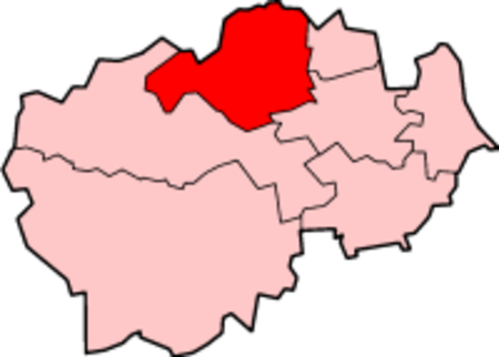
Derwentside was, from 1974 to 2009, a local government district in County Durham, England. The district took its name from the River Derwent, which made up part of the northern border of the district. Its main towns were Consett and Stanley, with the district council offices on Consett's Medomsley Road. The rest of the district was semi-rural, with numerous former pit villages running into one another.
Excerpt from the Wikipedia article Derwentside (License: CC BY-SA 3.0, Authors, Images).Derwentside
Pontop Pike Lane,
Geographical coordinates (GPS) Address Nearby Places Show on map
Geographical coordinates (GPS)
| Latitude | Longitude |
|---|---|
| N 54.867 ° | E -1.76 ° |
Address
Pontop Pike Lane
Pontop Pike Lane
DH9 9AP
England, United Kingdom
Open on Google Maps


