Yakir
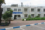
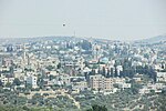
Yakir (Hebrew: יַקִּיר) is an Israeli settlement in the West Bank, 15 kilometers (9.3 mi) southwest of the Palestinian city of Nablus, near Revava and Nofim, on Road 5066, roughly between Barkan and Karnei Shomron. Organised as a community settlement founded in February 1981 on lands that the Israeli government expropriated from the nearby Palestinian village of Deir Istiya, it sits at 420 metres above sea level and is under the jurisdiction of Shomron Regional Council. In 2021, it had a population of 2,485. The international community considers Israeli settlements in the West Bank illegal under international law, but the Israeli government disputes this.
Excerpt from the Wikipedia article Yakir (License: CC BY-SA 3.0, Authors).Yakir
Shomron Regional Council
Geographical coordinates (GPS) Address Nearby Places Show on map
Geographical coordinates (GPS)
| Latitude | Longitude |
|---|---|
| N 32.150277777778 ° | E 35.115277777778 ° |
Address
380 Shomron Regional Council
Judea and Samaria, Palestinian Territories
Open on Google Maps


