Stoneywood, Aberdeen
Aberdeen geography stubsVillages in Aberdeen

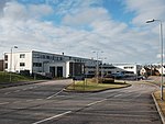
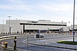
Stoneywood is a small area of the city of Aberdeen, Scotland, located between Dyce and Bucksburn near Aberdeen Airport. Stoneywood is served by two primary schools and one secondary school, which sits in Bucksburn. The main road running through the suburb is the A947, a north-south two-lane highway linking Aberdeen with Banff on the coast.
Excerpt from the Wikipedia article Stoneywood, Aberdeen (License: CC BY-SA 3.0, Authors, Images).Stoneywood, Aberdeen
Wellheads Drive, Aberdeen City Dyce
Geographical coordinates (GPS) Address Nearby Places Show on map
Geographical coordinates (GPS)
| Latitude | Longitude |
|---|---|
| N 57.1909 ° | E -2.1869822 ° |
Address
Stoneywood Parkvale
Wellheads Drive
AB21 7GQ Aberdeen City, Dyce
Scotland, United Kingdom
Open on Google Maps


