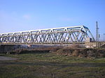
Battle of Kehl (1796)

During the Battle of Kehl (23–24 June 1796), a Republican French force under the direction of Jean Charles Abbatucci mounted an amphibious crossing of the Rhine River against a defending force of soldiers from the Swabian Circle. In this action of the War of the First Coalition, the French drove the Swabians from their positions in Kehl and subsequently controlled the bridgehead on both sides of the Rhine. Although separated politically and geographically, the fates of Kehl, a village on the eastern shore of the Rhine in Baden-Durlach, and those of the Alsatian city of Strasbourg, on the western shore, were united by the presence of bridges and a series of gates, fortifications and barrage dams that allowed passage across the river. In the 1790s, the Rhine was wild, unpredictable, and difficult to cross, in some places more than four or more times wider than it is in the twenty-first century, even under non-flood conditions. Its channels and tributaries wound through marsh and meadow and created islands of trees and vegetation that were alternately submerged by floods or exposed during the dry seasons. The fortifications at Kehl and Strasbourg had been constructed by the fortress architect Sébastien le Préstre de Vauban in the seventeenth century. The crossings had been contested before: in 1678 during the French-Dutch war, in 1703 during the War of the Spanish Succession and in 1733 during the War of the Polish Succession. Critical to success of the French plan would be the army's ability to cross the Rhine at will. Consequently, control of the crossings at Hüningen, near the Swiss city of Basel, and at Kehl, would give them ready access to most of southwestern Germany; from there, French armies could sweep north, south, or east, depending on their military goal.
Excerpt from the Wikipedia article Battle of Kehl (1796) (License: CC BY-SA 3.0, Authors, Images).Battle of Kehl (1796)
Beethovenstraße,
Geographical coordinates (GPS) Address Nearby Places Show on map
Geographical coordinates (GPS)
| Latitude | Longitude |
|---|---|
| N 48.566666666667 ° | E 7.8166666666667 ° |
Address
Beethovenstraße 42
77694 , Schneeflären
Baden-Württemberg, Germany
Open on Google Maps


