place

Esplanade Bridge

Bridges completed in 1997Bridges in Singapore
Esplanade Bridge (II)

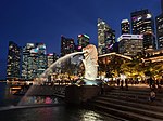
The Esplanade Bridge is a 261-metre-long (850 ft.) road bridge that spans across the mouth of the Singapore River in Singapore with the Esplanade - Theatres on the Bay on its northern abutment and the Merlion on the southern. The 70 metre-wide (230 ft.) low-level concrete arched bridge has seven spans and supports two four-lane carriageways and walkways along both sides.The bridge was built to provide faster vehicular access between Marina Centre and the financial district of Shenton Way and to displace traffic from St Andrew's Road and Connaught Drive. Construction of the bridge began in early 1994 and was completed in March 1997. Service 501 is the first bus route to pass by the Esplanade Bridge. On 10 July 1999, the right turn from Hill Street to Bras Basah Road is prohibited, and motorists had to use High Street and Parliament Place, together with the St Andrew's Road. The main contractor was Obayashi Corporation while the street lamps were designed by Light Cibles. The bridge then blocked views of the Merlion statue from the Marina Bay waterfront, raising a need for the original Merlion statue to be relocated from the back to the front of the bridge.

Excerpt from the Wikipedia article Esplanade Bridge (License: CC BY-SA 3.0, Authors, Images).

Esplanade Bridge
Esplanade Drive, Singapore Downtown Core

Geographical coordinates (GPS) Address Nearby Places
placeShow on map

Wikipedia: Esplanade BridgeContinue reading on Wikipedia

Geographical coordinates (GPS)

Latitude Longitude
N 1.2877777777778 ° E 103.85388888889 °
placeShow on map

Address

Esplanade Bridge

Esplanade Drive
049215 Singapore, Downtown Core
Singapore
mapOpen on Google Maps

Esplanade Bridge (II)
Share experience

Nearby Places

Downtown Core
Downtown Core

The Downtown Core is the historical and downtown centre of the city-state of Singapore and the main commercial area in Singapore excluding reclaimed lands with many integrated resorts such as the Marina Bay Sands, one of the most expensive buildings in the world, with the most expensive standalone casino at Bayfront Avenue. There are many skyscrapers in Raffles Place, Tanjong Pagar and Marina Bay CBD with a height limit of 280m. It is one of the eleven planning areas located within the most urbanised Central Area, forming the latter's dense urban core. It is bounded by Rochor to the north, Kallang to the northeast, Marina East and Marina South to the east, Straits View to the southeast, Bukit Merah to the south, as well as Outram, Museum and Singapore River to the west. As the financial Heart of Singapore, the Downtown Core houses the headquarters and offices of numerous corporations, as well as the Singapore Exchange. The area is also home to many governmental institutions, notably the seat of Parliament and the Supreme Court of Singapore. Singapore's modern history began in this area, when Stamford Raffles and representatives of the British East India Company landed along the banks of the Singapore River to set up a free port in Southeast Asia. As the old harbour grew along the mouth of the river bank, the city naturally expanded around it, creating what is now the Central Area. The name "Downtown Core" remains relatively unheard of and the term Central Business District (CBD) is commonly used in conversation instead. However, the area known as the CBD actually comprises a smaller area within the Downtown Core itself, taking up the south-western and western portions of the planning area. It is made up of eight subzones, Anson, Cecil, Clifford Pier, Maxwell, Phillip, Raffles Place and Tanjong Pagar and Marina Centre. The core of the CBD has since extended well beyond its boundaries and the term is even often at times used to refer to the Central Area as a whole.