place

Quadring Eaudike

Hamlets in LincolnshireSouth Holland, LincolnshireUse British English from September 2014
United Methodist Church, Quadring Eaudike, Lincs geograph.org.uk 84475

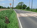
Quadring Eaudike is a hamlet in the South Holland district of Lincolnshire, England. It lies approximately 1 mile (2 km) east from the A152 road, and 2 miles (3 km) south-east from Donington. Quadring Eaudike is within the civil parish of Quadring , a village 1 mile to the west. The name Quadring, historically Quedhaveringe, is from the Old English meaning "muddy settlement of the family or followers of a man called Haefer".Quadring Eaudike once contained a chapel, noted by Thomas Allen as not remaining in 1834. The previous chapel of ease was referred to in 1872 at which time a Primitive and a Free Methodist chapel existed.In 1885 directory occupation listings included ten farmers, two blacksmiths, and the landlord of the New Inn public house. By 1933 there were seven farmers, one of whom was a cottage farmer and another a collector of Crown taxes, six smallholders, a fruit grower, and a beer seller.

Excerpt from the Wikipedia article Quadring Eaudike (License: CC BY-SA 3.0, Authors, Images).

Quadring Eaudike
Water Gate, South Holland Quadring CP

Geographical coordinates (GPS) Address Nearby Places
placeShow on map

Wikipedia: Quadring EaudikeContinue reading on Wikipedia

Geographical coordinates (GPS)

Latitude Longitude
N 52.8857 ° E -0.15197 °
placeShow on map

Address

Water Gate

Water Gate
PE11 4PY South Holland, Quadring CP
England, United Kingdom
mapOpen on Google Maps

United Methodist Church, Quadring Eaudike, Lincs geograph.org.uk 84475
Share experience

Nearby Places

Westhorpe, Lincolnshire

Westhorpe is a hamlet in the civil parish of Gosberton and the South Holland district of Lincolnshire, England. It is 30 miles (50 km) south-east from the city and county town of Lincoln, 6 miles (10 km) north from the nearest large town of Spalding, and 1 mile (1.6 km) west from parish village of Gosberton.Westhorpe is a linear settlement on the east to west Westhorpe Road. It is centred on the junction of Westhorpe Road with Windmill Lane which runs to the village of Risegate 1,000 yards (900 m) to the south. Adjacent to the east of this junction is a road bridge over the north to south National Rail line from Lincoln to Peterborough. Westthorpe Road, which starts at Gosberton, runs 1500yds to the west from the Windmill Lane junction, where it becomes Swale Bank (road) at the junction with Quadring Bank (road) which runs north.Today, Westhorpe is a settlement of detached properties including new-build houses and bungalows. There is a creative craft company, a soft furnishings company, and four farms. In 1872 Westhorpe was a hamlet of Gosberton parish. There were twelve farmers, a beerhouse owner, a miller, a grocer & draper, and a "thrashing machine owner".There are four Grade II listed buildings in Westhorrpe. At the west from the Windmill Lane junction is Yew Tree Farmhouse, which dates to the 16th century. It had a front facade added in the late 17th century, and was altered in the early 19th and the 20th century. The farmhouse is a mixture of two storeys with three bays, and a single storey with attic, and is in red brick laid in Flemish bond with a pantile roof. At the east from the Windmill Lane junction is an early 19th-century two-storey three-bay house of Flemish bond red brick, with sash windows, slate roof and a "lattice porch". Further west is an early 18th-century cottage, with later alterations from the 19th and 20th centuries. It is of three bays with sash windows, and in rendered brick. The pantile roof has gable dormers and attics. Further west is a single storey mid-18th-century cottage with three bays and a corrugated iron roof with dormer windows.Westhorpe is connected by bus to Quadring and Spalding. The nearest school is Gosberton Academy primary school in Gosberton village.

Swineshead Abbey

Swineshead Abbey was an abbey in Swineshead, Lincolnshire. The Abbey of St Mary, a Cistercian monastery, was founded in 1134 by Robert de Gresley. Gresley and his son, Albert, endowed the Abbey with 240 acres of land and other gifts. The Abbey was originally Savigniac and populated with monks from Furness Abbey, but was absorbed into the Cistercian order along with all the other Savigniac Houses in 1147. In 1170 the Abbot of Swineshead was reprimanded for owning villages, churches and serfs. King John spent a short time in the Abbey after losing his baggage in the fens, and just before his death in 1216. In William Shakespeare's King John, the name of the abbey where King John stayed is misspelled as "Swinsted Abbey" instead of "Swineshead Abbey", and this confusion was common in late-sixteenth century texts, for Swinstead is about 25 miles from Swineshead. It was dissolved in 1536 with the first Act of Suppression, its last Abbot being John Haddingham. The first documented reuse of the site dates from 1607 when a farmhouse, Abbey House, was built out of the abbey ruins by Sir John Lockton. The Abbey House is a Grade II listed building.The abbey occupied a slightly raised area in the marshland 1 km north east of Swineshead. In the raised area in the north-eastern part of the monument, partly overlain by Abbey House, are the buried remains of the abbey's inner court where the church, cloister and dorter (dormitory) would have been located. Adjacent to the west is another raised area where the remains of the outer court are located; these would include stables, barns and other agricultural and service buildings, together with the principal gatehouse of the abbey. The foundations of stone walls and fragments of medieval artefacts have been located in the outer court. Although the site is now a private residence it can still be seen from the main A52. If travelling south from Boston you reach the Baythorpe area of Swineshead, on the right is Manor Farm Shop and approximately 200m further, behind the trees, is Swineshead Abbey.