place

Colt Park

Geography of Hartford, ConnecticutNRHP infobox with nocatNational Register of Historic Places in Hartford, ConnecticutParks in Hartford County, ConnecticutParks on the National Register of Historic Places in Connecticut
Tourist attractions in Hartford, ConnecticutUrban public parks
Samuel Colt Memorial, Hartford, CT standing

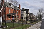
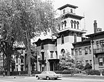
Colt Park is a city park in the southeast Hartford, Connecticut neighborhood of Sheldon/Charter Oak. The 106-acre (43 ha) park was established from the former Armsmear Estate of Samuel Colt and Elizabeth Jarvis Colt which was gifted to the city upon her death in 1905. Today the park is home to playgrounds, sports fields, a pool and Dillon Stadium. Colt Park was listed on the National Register of Historic Places on June 8, 1976, designated as part of the Colt Industrial District, valued for its association with industrialist Samuel Colt. It is bounded by Wawarme, Wethersfield, Hendricxsen, Van Dyke Avenues and Stonington, Maseek and Sequassen Streets.The grounds were originally developed in High Victorian Gothic style, and served as Colt's exclusive "pleasure-grounds." It was complete with large reflecting pools, rustic furnishings, fountains, urns, statuary, artificial ponds for fish and foul, a deer park, orchards, fields and more. Pope Park and Colt Park were the last major additions to the City of Hartford Parks System in 1898 and 1905, respectively. The two parks were intended to serve the traditionally working-class Hartford neighborhoods of Frog Hollow, Parkville, and Front Street.In 2019, Public Field #9 was renamed in honor of Hartford native and Negro league baseball player Johnny "Schoolboy" Taylor.

Excerpt from the Wikipedia article Colt Park (License: CC BY-SA 3.0, Authors, Images).

Colt Park
Wawarme Avenue, Hartford

Geographical coordinates (GPS) Address Nearby Places
placeShow on map

Wikipedia: Colt ParkContinue reading on Wikipedia

Geographical coordinates (GPS)

Latitude Longitude
N 41.751944444444 ° E -72.671111111111 °
placeShow on map

Address

Wawarme Avenue
06102 Hartford
Connecticut, United States
mapOpen on Google Maps

Samuel Colt Memorial, Hartford, CT standing
Share experience

Nearby Places

Hartford Ball Club Grounds

Hartford Ball Club Grounds was a baseball grounds in Hartford, Connecticut. It was home to the Hartford Dark Blues from 1874 to 1876, two years in the National Association and one in the National League. The Hartford club remained in the League for 1877 but played its home games at Union Grounds in Brooklyn, New York, whose last professional tenant had gone out of business. Contemporary maps show that the ballpark was bounded by Wyllys Street to the northwest and Hendricxsen Avenue to the northeast, with trees and residences along the south sides of the field. The stands were situated along Wyllys, and the diamond was set up with home plate pointing northwest. Across Hendricxsen to the northeast was the Church of the Good Shepherd, bounded by Van Block Avenue on its northeast side. In modern times, Hendricxsen ends at Masseek Street, well to the southeast, but the driveway from Wyllys into the church parking lot approximates the old Hendricxsen. The former ballpark site is a large lawn across from the church and the parking lot. The Hartford Base Ball Grounds was marked with a memorial bronze plaque in July 2008. The effort was led by Ronald Bolin. In February 2009 the plaque was stolen. It was recovered in 2017 from a scrap yard in Massachusetts. No decision has been made on whether to place it back on the site.In June 2013, the bases were marked with commemorative granite slabs on their approximate original locations on the grounds field just in front of the Church of the Good Shepherd's Caldwell Colt Memorial. The tribute was created and financed made by The Friends of Vintage Base Ball.

Capewell Horse Nail Company

The Capewell Horse Nail Company is a historic brick industrial complex located in the Hartford, Connecticut neighborhood of Sheldon/Charter Oak. It was built in 1903 by industrialist George Capewell at the corner of Charter Oak Avenue and Popieluszko Court after the previous headquarters burned down.Twenty years earlier, in 1881, Capewell invented a machine that efficiently manufactured horseshoe nails, and his success made Hartford the "horseshoe nail capital" of the world.The factory building includes a Romanesque Revival-style square tower with brick corbeling and a high pyramidal roof. The administration building is Hartford's finest example of Dutch architecture with highly articulated brick and brownstone details. The Jacobean front gable is detailed with elaborately patterned brickwork not found elsewhere in Hartford.The company was acquired by Hartford/Standard Machine Screw Company in 1970 and operated as a subsidiary. The company was then sold to private investors in the early 1980s. The horseshoe nail division was sold to Mustad in 1985 and the saw blade division was sold to Rule Industries in 1986. The plant was closed when the parachute hardware division was moved to Bloomfield in the late 1980s. Capewell continued to manufacture horsenails and other products at its Bloomfield facility until its closure in 2012.The Corporation for Independent Living, a non-profit housing group, acquired the property in 2014 and plans to convert it into apartments. The property was listed on the National Register of Historic Places in 2000.