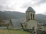
Col de Val Louron-Azet
Mountain passes of Hautes-PyrénéesMountain passes of the Pyrenees

The Col de Val Louron-Azet (or Col d'Azet) (elevation 1,580 m (5,180 ft)) is a mountain pass in the French Pyrenees in the department of Hautes-Pyrénées, which links Saint-Lary-Soulan and Azet, in the Aure Valley to the west, with Génos and Loudenvielle in the Louron Valley to the east. To the east of the pass is the Val-Louron ski station, and the GR10 footpath is also nearby.
Excerpt from the Wikipedia article Col de Val Louron-Azet (License: CC BY-SA 3.0, Authors, Images).Col de Val Louron-Azet
Route de Sailhan, Bagnères-de-Bigorre
Geographical coordinates (GPS) Address Nearby Places Show on map
Geographical coordinates (GPS)
| Latitude | Longitude |
|---|---|
| N 42.791944444444 ° | E 0.38111111111111 ° |
Address
Route de Sailhan
Route de Sailhan
65170 Bagnères-de-Bigorre
Occitania, France
Open on Google Maps


