Gulf Islands National Park Reserve

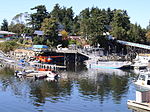
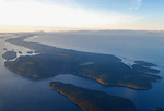
Gulf Islands National Park Reserve is a national park located on and around the Gulf Islands in British Columbia, Canada. In the National Parks System Plan, this park provides representation of the Strait of Georgia Lowlands natural region, the only place in Canada with a Mediterranean climate of dry, sunny summers and mild, wet winters, the result of a rain shadow effect from surrounding mountains between the region and the ocean. It has similar dominant vegetation as the Pacific Northwest, such as coastal Douglas-fir, western red cedar, shore pine, Pacific dogwood, bigleaf maple, and red alder, but also contains the northern extent of some of the more drought tolerant trees such as Garry oak and Arbutus. The park was created in 2003 as the fortieth national park. It covers 36 square kilometres (14 sq mi) of area on 16 islands and more than 30 islets, reefs and surrounding waters, making it the sixth smallest national park in Canada.
Excerpt from the Wikipedia article Gulf Islands National Park Reserve (License: CC BY-SA 3.0, Authors, Images).Gulf Islands National Park Reserve
Long Harbour Road, Salt Spring Island Electoral Area
Geographical coordinates (GPS) Address Nearby Places Show on map
Geographical coordinates (GPS)
| Latitude | Longitude |
|---|---|
| N 48.850555555556 ° | E -123.44777777778 ° |
Address
Long Harbour Road
Long Harbour Road
V8K 1A0 Salt Spring Island Electoral Area
British Columbia, Canada
Open on Google Maps


