place

Fresh Kills Landfill

1948 establishments in New York City2001 disestablishments in New York (state)Buildings and structures in Staten IslandEnvironmental issues in New York CityFormer landfills in the United States
History of Staten IslandUse mdy dates from November 2018Waste management infrastructure of New York City
GARBAGE SCOWS BRING SOLID WASTE, FOR USE AS LANDFILL, TO FRESH KILLS ON STATEN ISLAND, JUST EAST OF CARTERET, NJ NARA 548315

The Fresh Kills Landfill was a landfill covering 2,200 acres (890 ha) in the New York City borough of Staten Island in the United States. The name comes from the landfill's location along the banks of the Fresh Kills estuary in western Staten Island.The landfill opened in 1948 as a temporary landfill, but by 1955 it had become the largest landfill in the world, and it remained so until its closure in 2001. At the peak of its operation, in 1986, Fresh Kills received 29,000 short tons (26,000 t) of residential waste per day, playing a key part in the New York City waste management system. From 1991 until its closing it was the only landfill to accept New York City's residential waste. It consists of four mounds which range in height from 90 to about 225 feet (30 to about 70 m) and hold about 150 million short tons (140×10^6 t) of solid waste. The archaeologist Martin Jones characterizes it as "among the largest man-made structures in the history of the world."In October 2008, reclamation of the site began for a multi-phase, 30-year site redevelopment. The landfill has been developed into Freshkills Park.

Excerpt from the Wikipedia article Fresh Kills Landfill (License: CC BY-SA 3.0, Authors, Images).

Fresh Kills Landfill
West Shore Expressway, New York Staten Island

Geographical coordinates (GPS) Address Nearby Places
placeShow on map

Wikipedia: Fresh Kills LandfillContinue reading on Wikipedia

Geographical coordinates (GPS)

Latitude Longitude
N 40.57667 ° E -74.18733 °
placeShow on map

Address

West Shore Expressway
10312 New York, Staten Island
New York, United States
mapOpen on Google Maps

GARBAGE SCOWS BRING SOLID WASTE, FOR USE AS LANDFILL, TO FRESH KILLS ON STATEN ISLAND, JUST EAST OF CARTERET, NJ NARA 548315
Share experience

Nearby Places

Fresh Kills
Fresh Kills

Fresh Kills (from the Middle Dutch word kille, meaning "riverbed" or "water channel") is a stream and freshwater estuary in the western portion of the New York City borough of Staten Island. It is the site of the Fresh Kills Landfill, formerly New York City's principal landfill. The watershed (basin) of the Fresh Kills drains much of the wet lowlands of the western portion of the island and flows into the Arthur Kill around the Isle of Meadows. Its co-tributaries include the Rahway River, Morses Creek (New Jersey), Piles Creek, and, via Newark Bay, the Passaic River and the Hackensack River. The channel around the north end of the Isle of Meadows is sometimes called Little Fresh Kill and the southern channel is called Great Fresh Kill. The stream has two major branches. The north branch is Main Creek. The south branch is Richmond Creek, which drains much of the central part of the island, with its headwaters near Historic Richmond Town, on the southern end of the terminal moraine of the island. The system of streams provides recreational kayaking and wildlife viewing in the preserved wetlands. Since 2006, the New York City Department of Parks and Recreation has been implementing the master plan developed by landscape architecture firm Field Operations to transform Fresh Kills Landfill into Fresh Kills Park. Covering 2,200 acres (8.9 km2), nearly three times the size of Central Park, Fresh Kills Park will offer a variety of public spaces and facilities for varied activities including nature trails, mountain biking, community events, outdoor dining, sports fields, kayaking and canoeing. In addition, the park's design, ecological restoration and cultural and educational programming will emphasize environmental sustainability and a renewed public concern for our human impact on earth. Renewable energy is planned both for use in capital projects and for large-scale demonstration and public benefit. Photovoltaic cells, wind turbines and geothermal heating and cooling are components of current capital projects. While the full build-out will continue in phases for the next 30 years, the first sections of parkland to be developed opened in early 2010, and the park is expected to be complete by the 2030s.

Aspen Knolls

Aspen Knolls Estates is a private community in Staten Island, New York City. It contains 944 single-family town homes and is located in the neighborhood of Arden Heights on the island's south shore, near the intersection of Arthur Kill and Woodrow Road. The development of the community was originally for Navy Housing. Plans for this community began in the mid-1980s following the closing of the Saint Michael's orphanage (1982) with some of the land set aside for a church. The church also maintained a convent for the Presentation Sisters on the east side of the property. The church, now closed, and its grounds are surrounded on three sides by the Aspen Knolls Estates community, and by Arthur Kill Rd. on its fourth side. The Aspen Knolls Estates community was originally meant for housing of Navy families. However, due to Base Realignment and Closure, the housing contract was terminated in November 1994 after the closure of the Staten Island Homeport in Stapleton. With the community already planned, its builders decided to go through with construction and sell the homes to regular citizens. Construction began in 1995 and was finished in early 2006. During this time period, people moved into the community as each house was finished being built. The community today has over 4,000 residents. Surrounding two sides of this development (alongside the rear of homes lining Ilyssa Way from Arthur Kill Road to Woodrow Avenue.) is Arden Woods, with almost 200 undeveloped acres of forest and wetland, including some hiking trails.

Oceanic H&L Company No. 1

Oceanic H&L Co.No.1 INC is a volunteer fire department located in the Travis neighborhood of Staten Island in New York City. It works in cooperation with the New York City Fire Department. Oceanic was formed April 17, 1881. The firehouse was moved by horse from its original location at 29 Meredith Avenue in 1902 to its current location at 4010 Victory Boulevard.Typically the department responds in addition to the initial assignment dispatched by the FDNY. The department is fully trained and operational with the apparatus and equipment they have. Therefore, when they arrive on a scene first, or when needed, they will implement their operations alongside FDNY as applicable. Oceanic currently operates three pieces of apparatus, Engine 1, a 1997 Seagrave (formerly FDNY Engine 40), and the Brush Unit, a 1959 Dodge M37/1975 Scat. Brush Unit, a 1993 M35A3WW (with winch) AM General.Eastern Surplus modified the apparatus by shortening the chassis and removing one of the rear axles, converting the unit to four wheel-drive. It is equipped with a skid with a 24-ton winch, 75 GPM pump, 300-gallon water tank and 12-gallon foam tank. This Brush truck was part of a 100,000.00 grant 50,000.00(truck) and 50,000.00 (building maintenance) provided by Assemblyman Michael Cusick. Oceanic is the oldest of the two currently existing volunteer fire companies in the county. Richmond Engine Co. 1 was founded in 1903. They are dispatched by the FDNY Staten Island Communications Office and operate on the FDNY Staten Island frequency. Oceanic has a roster of 38 Active members headed by Captain James Wakie. Metropolitan Fire Explorer Company was founded in 1976. They are located on the grounds of Seaview Hospital in Willowbrook. While Metro Fire operates two fire engines, they respond primarily to rescue calls, search and rescue, event standbys, and perform fire patrols.

Mid-Island, Staten Island

Mid-Island is frequently applied to a series of neighborhoods within the New York City borough of Staten Island. Under the definition most commonly adhered to, Mid-Island comprises all of the communities whose ZIP Code is 10314, plus Sunnyside within ZIP Code 10301, along with the western slope of Todt Hill. Mid-Island communities thus include Graniteville, Bulls Head, Willowbrook, and New Springville, Sometimes the localities situated along the Arthur Kill between the Staten Island Expressway and the Fresh Kills — Bloomfield, Chelsea and Travis — are said to be on the island's West Shore; otherwise they too would fall within Mid-Island as their ZIP Code is 10314. Like all of Staten Island except for the North Shore, farms dominated the Mid-Island region until the 1960s, when new home construction began to rise sharply. The opening of the Verrazano-Narrows Bridge in 1964 did much to stimulate this construction, but the effects of this phenomenon were first seen most profoundly on the East Shore, not spreading inland until nearly the end of the decade. In addition to starting somewhat later, the population boom experienced in Mid-Island also exhibited some important demographic differences from that which took place to the east, as in Mid-Island Jewish transplants (from Queens as well as Brooklyn) tended to predominate, in contrast to the heavily Italian-American influx experienced on the East Shore. These demographic differences are not present today with mostly Italian-Americans dominating the area. The ZIP Code 10314, which covers much of the Mid-Island area has the largest percentage of Asians of any ZIP Code on Staten Island, at 13.3% Non-hispanic Asian.The Mid-Island region's character was transformed dramatically in 1973, when the Staten Island Mall opened in New Springville, on a site that was originally used as an airport. This led to the Richmond Avenue corridor, from New Springville to Graniteville, becoming the island's liveliest commercial strip, spawning much traffic congestion in the area; even during midday hours on weekdays, traffic is typically moderate to heavy along Richmond Avenue and Victory Boulevard, which intersects Richmond Avenue in Bulls Head. Besides the Staten Island Mall, other prominent landmarks found within Mid-Island include the former Willowbrook State School (now a campus of the City University of New York), St. Francis Seminary (on the property of which the highest point on Staten Island is located), and the former New York City Farm Colony adjacent to Sea View Hospital and Home, a city-run nursing home. Most of Mid-Island lies within the NYPD's 122nd Precinct, headquartered in the East Shore community of New Dorp, a considerable distance away; however, in 2005 the city approved plans to build a fourth police precinct on the island (which presently has three), with the new precinct's station house to be built at 974 Richmond Avenue, near Forest Avenue and the Baron Hirsh Cemetery. The MTA has the Yukon Avenue Bus Depot in New Springville.

William T. Davis Wildlife Refuge

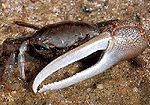
The William T. Davis Wildlife Refuge (WTDWR) is an 814-acre (3.29 km2) wildlife refuge straddling the New Springville and Travis sections of Staten Island. The park was named in honor of Staten Island native William T. Davis, a renowned naturalist and entomologist who along with the Audubon Society started the refuge with an original acquisition of 52 acres (210,000 m2). Additional acreage was acquired in increments and the park is today 814 acres (3.29 km2). Beginning in 2010, the adjacent 223-acre (0.90 km2) North Park section of Freshkills Park (the redevelopment of the Fresh Kills Landfill) has undergone preparation to serve as an expansion of the wildlife refuge. This refuge is the sixth largest park in New York City out of a total of 1,700 parks; it is only 30 acres (120,000 m2) smaller than Central Park. The United for Wildlife Rehabilitation and Education Center is located at the William T. Davis Wildlife Refuge near the intersection of Travis and Richmond Avenues. The center seeks “to care for sick, injured and orphaned wildlife and return them to the wild.” The center is sponsored by the New York City Parks Department and serves as a holding facility for the New York State Department of Environmental Conservation. Injured animals convalesce at the facility and are eventually returned to the wild. The refuge is at the confluence of Main and Springville Creeks, two tributaries of Freshkill Creek, a tidal creek which is connected to the Arthur Kill. Within the refuge there are expansive salt marshes with low marsh bordering the creeks and flooding twice daily with the high tide and a more expansive area of high marsh which floods occasionally during exceptionally high tide. In the low marsh, saltmarsh cordgrass (Spartina alterniflora) is the dominant species while saltmeadow cordgrass (Spartina patens) is found in the high marsh. There are degraded areas of the marsh in which the common reed (Phragmites australis), an invasive species, has supplanted the native cordgrass; this generally occurs in the high marsh zone where the soil is saturated but infrequently inundated. In addition to the salt marshes there are forested uplands and a swamp forest and small spring-fed ponds. Marine life: The marine life present in the refuge includes the fiddler crab (Uca pugnax), ribbed mussel (Geukensia demissa), clam and oyster. Bird species: Over 117 bird species have been recorded at the William T. Davis Wildlife Refuge, including sharp-tailed sparrow (Ammodramus caudacutus), and wood duck (Aix sponsa). Among the species of raptors which frequent the park are red-tailed hawks (Buteo jamaicensis) red-shouldered (Buteo lineatus), and rough-legged (Buteo lagopus) hawks and osprey. There are also various species of owl such as Barn (Tyto alba), great horned (Bubo virginianus), and short-eared (Asio flammeus). The Great blue heron hunts fish along the tidal marshes. Mammals: Muskrats (Ondatra zibethica) live along the marshes; there are also raccoons, eastern grey squirrel, chipmunk, and a few species of field mouse.In addition to the invasive common reed, some sections of the refuge especially along Travis Ave. are overrun by Japanese knotweed. The fresh-water New Springville Creek, which originates in the Greenbelt, flows into the park. The creek is subterranean for most of its length, having been enclosed in pipe.In the east of the refuge was the burial site for six people murdered and dismembered by the Bonanno crime family associate Thomas "Tommy Karate" Pitera, who was sentenced to life in prison in 1992.