place

Lava Butte

Buttes of OregonCascade VolcanoesCinder cones of the United StatesMountains of Deschutes County, OregonMountains of Oregon
Newberry National Volcanic MonumentSubduction volcanoesVolcanoes of Deschutes County, OregonVolcanoes of OregonVolcanoes of the United States
Lavabutte3
Lavabutte3

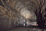
Lava Butte is a cinder cone in central Oregon, United States, just west of U.S. Route 97 between the towns of Bend, and Sunriver in Deschutes County. It is part of a system of small cinder cones on the northwest flank of Newberry Volcano, a massive shield volcano which rises to the southeast. The cinder cone is capped by a crater which extends about 60 feet (20 m) deep beneath its south rim, and 160 feet (50 m) deep from the 5,020-foot (1,530 m) summit on its north side. Lava Butte is part of the Newberry National Volcanic Monument.

Excerpt from the Wikipedia article Lava Butte (License: CC BY-SA 3.0, Authors, Images).

Lava Butte
National Forest Development Road 9702-100,

Geographical coordinates (GPS) Address Nearby Places
placeShow on map

Wikipedia: Lava ButteContinue reading on Wikipedia

Geographical coordinates (GPS)

Latitude Longitude
N 43.917857481 ° E -121.356032936 °
placeShow on map

Address

National Forest Development Road 9702-100

Oregon, United States
mapOpen on Google Maps

Lavabutte3
Lavabutte3
Share experience

Nearby Places

Benham Falls
Benham Falls

Benham Falls are rapids of the Deschutes River located between Sunriver and Bend, Oregon, United States. With a pitch of 22.5°, they are rated Class 5 for watercraft, and are the largest falls on the upper Deschutes. The falls were created by the eruption of nearby Lava Butte approximately 6,000 years ago, as the lava flow dammed the Deschutes, forming a lake known as Lake Benham. The river eventually flowed over the dam, draining the lake and thus forming Benham Falls. Around 1885, J. R. Benham attempted and failed to file a land claim near the falls, though they were later named for him.Today, there are forest roads connecting Benham Falls to Lava Butte, Lava River Cave, and Sunriver Resort. A footbridge connects the forest road to an easy-to-navigate trail near the river and falls. The shady area has much wildlife and flowers. Because of this, the area also has mosquitoes. Additionally, the United States Forest Service has established a few lookouts over the gorge for viewers. Hikers and mountain bikers who continue on this trail pass Dillon Falls and Lava Island Falls, and eventually, the city of Bend. Benham Falls is relatively easier to see compared to the falls downstream, because it is not surrounded by lava flow from Lava Butte, but surrounded by forest. Because of its location, it is also much more popular. Benham Falls is also in the Deschutes National Forest and the Newberry National Volcanic Monument. Benham Falls Recreation Site and Benham Falls West Recreation Site are located nearby.