place

Bayonne Bridge

1931 establishments in New Jersey1931 establishments in New York (state)1931 establishments in New York CityBridges by Othmar AmmannBridges completed in 1931
Bridges in Hudson County, New JerseyBridges in Staten IslandCass Gilbert buildingsHistoric American Engineering Record in New JerseyHistoric American Engineering Record in New York CityHistoric Civil Engineering LandmarksInterstate vehicle bridges in the United StatesPort Authority of New York and New JerseyRoad bridges in New JerseyRoad bridges in New York CitySteel bridges in the United StatesThrough arch bridges in the United StatesToll bridges in New JerseyToll bridges in New York CityTransportation in Bayonne, New JerseyTransportation projects in New York CityUse mdy dates from January 2019
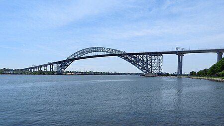
High BB from Bayonne jeh

Bayonne Bridge is an arch bridge spanning the Kill Van Kull and connecting Bayonne, New Jersey with Staten Island in New York City. It carries New York State Route 440 (NY 440) and New Jersey Route 440. It is the sixth-longest steel arch bridge in the world, and it was the longest in the world at the time of its completion. The bridge is also one of four connecting New Jersey with Staten Island; the other two roadway bridges are the Goethals Bridge in Elizabeth and Outerbridge Crossing (which also carries Route 440) in Perth Amboy, and the rail-only span is the Arthur Kill Vertical Lift Bridge, all of which cross the Arthur Kill. The original 151-foot (46 m) roadway carried two lanes of motor traffic in each direction, as well as a walkway. Completed in 1931, the Bayonne Bridge was built by the Port Authority of New York and New Jersey, which still operates the bridge. It was designed by Swiss master bridge-builder Othmar Ammann and architect Cass Gilbert. A project to provide increased clearance required to accommodate New Panamax ships began in 2013, and was completed in two stages between 2017 and 2019. The new roadways each carry two lanes of unidirectional motor traffic plus shoulders for disabled vehicles in addition to a separate path for pedestrians and bicyclists, which opened on May 24, 2019. The desired navigational clearance was achieved June 8, 2017.

Excerpt from the Wikipedia article Bayonne Bridge (License: CC BY-SA 3.0, Authors, Images).

Bayonne Bridge
Point View Terrace,

Geographical coordinates (GPS) Address External links Nearby Places
placeShow on map

Wikipedia: Bayonne BridgeContinue reading on Wikipedia

Geographical coordinates (GPS)

Latitude Longitude
N 40.642 ° E -74.142 °
placeShow on map

Address

Bayonne Bridge

Point View Terrace
07002
New Jersey, United States
mapOpen on Google Maps

linkWikiData (Q812580)
linkOpenStreetMap (13365299)

High BB from Bayonne jeh
Share experience

Nearby Places

Reformed Church on Staten Island

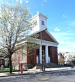
The Reformed Protestant Dutch Church on Staten Island, also known as the Reformed Church on Staten Island (RCSI), is the oldest corporation on Staten Island still engaged in its original enterprise. The Congregation is continuous since 1656. The Church has been on the same spot, in what today is Port Richmond Staten Island, since 1680. The town grew up around the Church, not the other way around. The Archives date to1688. The Burial Place and Baptismal Records date to 1696. The first Church was most likely a barn. The second church, built in 1717, was destroyed by the British during the American Revolutionary War. The third church was built in 1787. The current, and fourth church, was built in 1844 in the Greek Revival style. It is a brick building set on a fieldstone foundation. The front facade features a portico with twin sets of flanking brick pilasters and a central pair of fluted Doric order columns. In 1844 the Congregation reoriented the entrance to what is today Port Richmond Avenue thanks to land donated by Daniel Tompkins, Vice President under James Monroe and founder of Tompkinsville. RCSI Congregants played pivotal roles in American history. The Burial Place has 45 heroes of the wars that created America: The American Revolution, The War of 1812, and The Civil War. One of the Congregation, Cornelius Vanderbilt, amassed one of the world's greatest fortunes and created many laws and procedures that characterize our the modern business world. The 1844 Church and 1696 Burial Place are New York City Landmarks. The site was added to the National Register of Historic Places in 2005 and is a National Historic Site nominee. There is detailed information on the entire history of the Congregation from its role in early Staten Island, through the creation of our nation, to today at olddutchchurchnyc.org. The continuity is extraordinary. Many descendants of the early congregation still live in Port Richmond, on Staten Island, and in neighboring states. Eighty-three Staten Island streets are named for families in the Burial Place. The total rises to 125 streets with the names of families in the Baptismal Book. One current Congregant's family has been with the Reformed Church since 1568 in the Netherlands. In 1730 that same family called the Rev. Cornelis Van Santvoord (1686-1752. RCSI Domini from 1718 to 1740.) to serve their newly formed congregation in Bensalem PA.

Elm Park, Staten Island

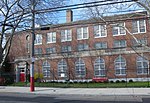
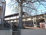
Elm Park is the name of a small park in the Port Richmond section of Staten Island, one of the five boroughs of New York City, United States. The park is located across Innis Street from Port Richmond High School. The name "Elm Park" is sometimes used to denote the area from its namesake westward for several blocks, lending its name to the former Elm Park Station on the North Shore Branch of the Staten Island Railway. The station was situated directly beneath Morningstar Road. Passenger service on this branch of the railway was halted in 1953; a dilapidated remnant of the station's platform still exists, but the stairways leading to the street have been removed. At various times, the neighborhood was known as Jacksonville (c. 1830) and Lowville (c. 1850). Its present name was given to it by a local physician, Dr. John T. Harrison, and refers to the elm trees that could be found on the doctor's estate. The last exit on New York State Route 440 before the Bayonne Bridge is in Elm Park, which also contains one of two Catholic cemeteries on Staten Island named St. Mary's Cemetery; the other cemetery, located in Grasmere, is much larger than the Elm Park cemetery. This often causes confusion. In 2008 Senator Charles Schumer and other Staten Island representatives proposed a Park and Ride under the bridge, for users of bus service to Bayonne, New Jersey. Residents have been opposed to this move, yet local businesses, according to the Staten Island Advance, support it.