place

Holyoke station

1883 establishments in MassachusettsAmtrak stations in MassachusettsBuildings and structures in Holyoke, MassachusettsHenry Hobson Richardson buildingsRailway stations closed in 1966
Railway stations in Hampden County, MassachusettsRailway stations in the United States opened in 1883Railway stations in the United States opened in 2015Richardsonian Romanesque architecture in MassachusettsStations along Boston and Maine Railroad linesUse mdy dates from June 2018
Southbound Vermonter at Holyoke station, August 2018

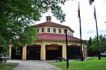
Holyoke station is an Amtrak intercity train station near the corner of Main and Dwight streets in Holyoke, Massachusetts, United States. The station opened on August 27, 2015, eight months after Amtrak's Vermonter service was re-routed to the Connecticut River Line through the Pioneer Valley. The first railroad station in Holyoke had opened in 1845, followed by the H.H. Richardson-designed Connecticut River Railroad Station in 1885. Though passenger service to Holyoke ended in 1966, the 1885 depot is still extant. The opening of the new station returned passenger rail service to Holyoke for the first time in 49 years, and to the Dwight and Main streets site for the first time in 130 years. A pilot program added two daily Amtrak Shuttle round trips in August 2019 under the Valley Flyer moniker.

Excerpt from the Wikipedia article Holyoke station (License: CC BY-SA 3.0, Authors, Images).

Holyoke station
Main Street, Holyoke

Geographical coordinates (GPS) Address Nearby Places
placeShow on map

Wikipedia: Holyoke stationContinue reading on Wikipedia

Geographical coordinates (GPS)

Latitude Longitude
N 42.204263 ° E -72.60287 °
placeShow on map

Address

Main Street 81
01040 Holyoke
Massachusetts, United States
mapOpen on Google Maps

Southbound Vermonter at Holyoke station, August 2018
Share experience

Nearby Places

North High Street Historic District (Holyoke, Massachusetts)

The North High Street Historic District is a historic district encompassing part of the downtown area of Holyoke, Massachusetts. When first added to the National Register of Historic Places in 1986, the district encompassed North High Street, between Dwight and Lyman Streets. This part of High Street was built between 1850 and 1885, and is lined with masonry buildings in Italianate and Second Empire styles. In 1992 the district was extended southward, adding three blocks of High Street between Dwight and Essex Streets. This expansions encompasses the growth of Holyoke during the height of its commercial success, between 1880 and 1930; it also includes the separately-listed Holyoke City Hall. The district was extended a third time, in 2008, adding a complex of three buildings at Dwight and Maple Streets that now houses the Holyoke Health Center.Prior to 1847, the area that is now Holyoke was a sleepy agricultural area of West Springfield. In that year, investors from Boston purchased a mill privilege on the Connecticut River, on which they proceeded to develop the industrial sites that fueled the growth of the city. By 1880, Holyoke was one of the nation's major producers of paper products, and had a population of more than 10,000. Many buildings on High Street in the 1986 district boundaries date to this period of rapid growth, which was completely built out by 1880. Between 1880 and 1930 the area northeast of the early cluster of commercial buildings was developed, spurred by the construction of City Hall in the 1870s, and by the extension of streetcars line for the Holyoke Street Railway in the latter half of the 19th century.

Precious Blood Church fire

Precious Blood Church of Holyoke, Massachusetts, burned on May 27, 1875, killing 78 people. The fire started at the front of the church as a candle flame ignited a curtain. There was a crush of people through the entrance at the back left and many people could not leave. It is one of the deadliest fires in American history, and was also known by newspapers domestic and foreign as "The Holyoke Disaster".Panic caused people to rush from the upper levels to a front door. The door was made to open inward only so many were trapped against the door. Reverend Andre Dufresne was the parish priest. He tried to calm the people and direct them as much as possible. A list of the dead is given below by first and last name and then age. Many were buried in a common grave on May 29 at the Precious Blood Cemetery in South Hadley. All were French Canadians. The wooden church had been built in 1870 and was replaced in 1876 by a brick church. There is a monument for the dead at the cemetery. The parish priest was also reburied there. The names have been taken directly from the monument. The names were determined from the Holyoke Deaths Register and from various newspaper articles. The accuracy is very high but there might still be small errors since there was a language barrier from the French immigrants to the English speaking officials and newspaper writers. Also the chaos of the days after the burning of the church was very high. One obvious correction that can be made in the future is seen in that French would use Marie and Celine and never Mary and Selina.The church complex is located on the city block formed by Cabot, South East, Clemente, and Hamilton Streets. Only the convent and rectory remain today since the brick church and school were dismantled. The Park Street School was located on the other side of Hamilton Street between Park and South East Streets. The school was used as a temporary morgue for the fire victims. The cemetery is on Willimansett Street Extension near the intersection of Routes 33 and 202 in South Hadley. The black memorial is in the center of the cemetery and the priest is buried behind that. The event and its aftermath were also later depicted in some detail in the Franco-American novel Mirbah by Emma Port-Joli Dumas, originally published in Holyoke's La Justice.