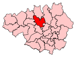
Redvales
Areas of Greater ManchesterBury, Greater ManchesterGeography of the Metropolitan Borough of BuryGreater Manchester geography stubs

Redvales is a residential district to the south of Bury town centre in Greater Manchester in the United Kingdom. The population of the Bury Ward at the 2011 census was 11,483. Roughly-speaking, the area occupies the area from Manchester Road to the River Irwell, crossed by Radcliffe Road, Redvales Road and Tarn Drive.
Excerpt from the Wikipedia article Redvales (License: CC BY-SA 3.0, Authors, Images).Redvales
Whitefield Road,
Geographical coordinates (GPS) Address Nearby Places Show on map
Geographical coordinates (GPS)
| Latitude | Longitude |
|---|---|
| N 53.5771 ° | E -2.3011 ° |
Address
Whitefield Road
Whitefield Road
BL9 9PR , Redvales
England, United Kingdom
Open on Google Maps


