place

Peebles Township, Allegheny County, Pennsylvania

Allegheny County, Pennsylvania geography stubsFormer townships in Allegheny County, PennsylvaniaPittsburgh stubs

Peebles Township was a township in Allegheny County, Pennsylvania. Created out of Pitt Township in 1833, it originally included most of what is now the eastern part of the city of Pittsburgh from the Monongahela River in the south (today's Hazelwood) to the Allegheny River in the north. Portions of Peebles broke away to form the borough of Lawrenceville (1834) and the townships of Collins (1850) and Liberty (1864). Those municipalities and the remainder of Peebles Township were incorporated into Pittsburgh in 1868.

Excerpt from the Wikipedia article Peebles Township, Allegheny County, Pennsylvania (License: CC BY-SA 3.0, Authors).

Peebles Township, Allegheny County, Pennsylvania
Pocusset Street, Pittsburgh

Geographical coordinates (GPS) Address Nearby Places
placeShow on map

Wikipedia: Peebles Township, Allegheny County, PennsylvaniaContinue reading on Wikipedia

Geographical coordinates (GPS)

Latitude Longitude
N 40.43 ° E -79.93 °
placeShow on map

Address

Pocusset Street 5514
15217 Pittsburgh
Pennsylvania, United States
mapOpen on Google Maps

Share experience

Nearby Places

Panther Hollow (valley)

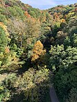
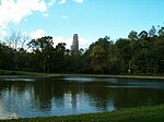
Panther Hollow is a wooded valley in Pittsburgh, Pennsylvania, that runs approximately 1.5 mi (2.4 km) west to east through Schenley Park. It begins at Boundary Street in Junction Hollow and ends near Hobart Street in Squirrel Hill. Curiously, the neighborhood of Panther Hollow in Central Oakland is not actually in the valley of Panther Hollow itself, but rather in Junction Hollow. The hollow features the man-made Panther Hollow Lake, on the east end of which is the confluence of Panther Hollow Run (which generally follows the valley) and Phipps Run. Created in the 1880s, Panther Hollow Lake was once the center of a busy picnic and recreational area that included a boat house adjacent to the lake from which couples could rent boats for an afternoon. The boathouse was razed in the 1930s. Today, hiking trails follow both streams. The heavily-travelled Panther Hollow Road lies on the southern edge of the hollow. It begins where the Boulevard of the Allies ends at Anderson Bridge in Oakland and continues through Schenley Park to become Hobart Street to the park's east. Above the lake some 120 feet is Panther Hollow Bridge, which carries Schenley Drive over the hollow. The landmark 1897 bridge features bronze sculptures by Giuseppe Moretti of four panthers, crouching as sentinels, on each corner. The hollow is named for the mountain lions once native to the area. The University of Pittsburgh, adjacent to the park, also uses the panther as its mascot. At one time, painting or defacing the Moretti sculptures was a popular form of vandalism committed by the fans of rival universities prior to the schools' football games.