Grangetown, Cardiff

Grangetown (Welsh: usually Grangetown, also Trelluest) is a district and community in the south of Cardiff, capital of Wales. It is one of the largest districts in the south of the city and is bordered by Riverside, Canton and Butetown. The River Taff winds its way through the area. Adjacent to the city's Cardiff Bay area, Grangetown is experiencing a period of gentrification and improvements in its infrastructure. Its population as of 2011 was 19,385 in 8,261 households. One of the "five towns of Cardiff", the others are Butetown, Crockherbtown, Newtown and Temperance Town. Grangetown is a diverse and multiracial district and has a significant population of Somali, Asian and mixed-race residents. It is home to a Swaminarayan Temple and various mosques.
Excerpt from the Wikipedia article Grangetown, Cardiff (License: CC BY-SA 3.0, Authors, Images).Grangetown, Cardiff
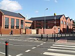
Penhevad Street, Cardiff Grangetown
Geographical coordinates (GPS) Address Nearby Places Show on map
Geographical coordinates (GPS)
| Latitude | Longitude |
|---|---|
| N 51.4675 ° | E -3.1852777777778 ° |
Address
Penhevad Street
Penhevad Street
CF11 7LS Cardiff, Grangetown
Wales, United Kingdom
Open on Google Maps


