place

Kirby Hill, Richmondshire

Civil parishes in North YorkshireUse British English from February 2017Villages in North Yorkshire
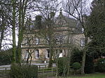
St Peter and St Felix church, Kirby Hill

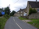
Kirby Hill, historically also known as Kirby-on-the-Hill, is a village and civil parish in the Richmondshire district of North Yorkshire, England. The village is about 1 mile (1.6 km) south of Ravensworth and about 4 miles (6 km) north-west of the town of Richmond. The parish population is about 60. At the 2011 census, it was less than 100. Population data about Kirby Hill is now included in population data about the parish of Gayles. Kirby Hill was a township in the parish of Kirkby Ravensworth until 1866, when it was made a separate civil parish.As early as 1859, the centre of the village green featured "a beautiful spring". It continued to be used by residents until at least 1932. Sir Nikolaus Pevsner described Kirby Hill as "a perfect village, but ... also ... exceptional".

Excerpt from the Wikipedia article Kirby Hill, Richmondshire (License: CC BY-SA 3.0, Authors, Images).

Kirby Hill, Richmondshire

Geographical coordinates (GPS) Address Nearby Places
placeShow on map

Wikipedia: Kirby Hill, RichmondshireContinue reading on Wikipedia

Geographical coordinates (GPS)

Latitude Longitude
N 54.45417 ° E -1.785 °
placeShow on map

Address


DL11 7JJ , Kirby Hill
England, United Kingdom
mapOpen on Google Maps

St Peter and St Felix church, Kirby Hill
Share experience

Nearby Places

Ravensworth
Ravensworth

Ravensworth is a village and civil parish in the Holmedale valley, within the Richmondshire district of North Yorkshire, England. It is approximately 4.5 miles (7.2 km) north-west of Richmond and 10 miles (16 km) from Darlington. The parish has a population of 255, according to the 2011 census.Ravensworth was historically situated in the North Riding of Yorkshire, but has been a part of North Yorkshire since 1974 as a result of the Local Government Act of 1972. The village has ancient origins, dating back to the time of Viking settlements. In it are the remains of the 14th century, Grade-1-listed Ravensworth Castle, the ancestral home of the FitzHugh family. After the FitzHugh line came to an end, the castle was abandoned. Beginning in the mid-16th century, it began to be dismantled, but the gatehouse remains almost wholly intact. There are a number of listed buildings situated around the village green, mostly dating from the eighteenth century. Many of them were constructed using raw materials from the castle. Today, Ravensworth is primarily a commuter village, and the historically important agricultural sector now employs only a small number of people. Historically, stone mining was important to the local economy. Although it died out in the twentieth century, a sandstone quarry was recently opened just outside the village. Amenities include a primary school, a public house and a large village green. Ravensworth is most frequently mentioned in the media as the home of the former international cricketer Ian Botham. The village is also known regionally for the Ravensworth Nurseries horticultural business.

Dalton, west North Yorkshire

Dalton is a village and civil parish in North Yorkshire in England. Dalton is situated about six miles north-west of Richmond and about five miles south-east of Barnard Castle within the council district of Richmondshire and close to the A66 trans-Pennine trunk road. It was listed in the Domesday book. The Dalton parish boundary includes the village itself as well the houses at Dalton Heights (off the road to Newsham) plus numerous surrounding farms. The population of the parish was 147 according to the 2001 census, increasing to 181 at the 2011 Census. Dalton includes a farming community, both arable and stock, and is sited on a stream or beck which is a tributary of the River Swale. The Dalton & Gayles Village Hall, which is shared with the neighbouring village of Gayles, is located in Dalton; there is also a Church of England church, St James's, built in 1897. The name Dalton comes from Old English and means farmstead or village in a valley.To the South of Dalton there are the remains of a camp called ‘Castle Steads’, and further south there is a block of stone called ‘Stone Man’ which used to be a landmark, until the stones were taken away to make fences. A mile south-east of the Stone Man, a stone chest was found which had a ‘kale pot’, said to have contained money.In 1835, an allowance of £40 was given to the schoolmaster by the Kirby-Ravensworth hospital for the education of the poor children. By 1890, there was a mixed school attended by 50 students.