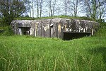
Siege of Fort-Louis (1793)
Battles in Grand EstBattles involving AustriaBattles involving BavariaBattles involving FranceBattles involving Hesse-Kassel ... and 5 more
Battles of the French Revolutionary WarsConflicts in 1793Military history stubsSieges of the French Revolutionary WarsSieges of the War of the First Coalition

The siege of Fort-Louis (14 October – 14 November 1793) saw a force composed of Habsburg Austrians, Hessians and Bavarians led by Franz von Lauer lay siege to Fort-Louis which was held by a Republican French garrison under Michel Durand. The French capitulated after a defense lasting exactly one month. The siege occurred during the War of the First Coalition, part of the French Revolutionary Wars. In 1793 the fortress was sited on an island in the Rhine River, but today Fort-Louis is a village in the Bas-Rhin department in France.
Excerpt from the Wikipedia article Siege of Fort-Louis (1793) (License: CC BY-SA 3.0, Authors, Images).Siege of Fort-Louis (1793)
Rue Saint-Louis, Haguenau-Wissembourg
Geographical coordinates (GPS) Address Nearby Places Show on map
Geographical coordinates (GPS)
| Latitude | Longitude |
|---|---|
| N 48.801944444444 ° | E 8.0572222222222 ° |
Address
Rue Saint-Louis 8
67480 Haguenau-Wissembourg
Grand Est, France
Open on Google Maps


