place

No 1 Poultry

Buildings and structures in the City of LondonCommercial buildings completed in 1997EngvarB from January 2014Grade II* listed buildings in the City of LondonGrade II* listed office buildings
Office buildings in LondonPostmodern architecture in the United KingdomRoman LondonSuicides in the United Kingdom
No 1 Poultry (15481592400)

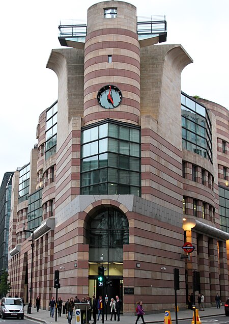
No 1 Poultry is a building in the City of London, allocated to office and commercial use. It occupies the apex where the eastern ends of Poultry and Queen Victoria Street meet at Mansion House Street, the western approach to Bank junction. The design, by James Stirling, was constructed after the architect's death. It replaced a neogothic, conical-turretted, predecessor retail building, owned by developer Rudolph Palumbo and subsequently by his son, developer Peter Palumbo. Another option was a modernist minor skyscraper designed by Ludwig Mies van der Rohe in the manner of the Seagram Building in New York City – but dropped having failed in an influential architectural and planning show-down in the 1970s. The tall but less towering design, in a postmodernist style with an outer shell of even bands of rose-pink and muted yellow stone, prevailed. The point of the apex, as before, has a clock face but higher, as above a large pointed apex set of 30 window panes. In 2016, the landowner proposed exterior alteration. Building users, experts and neighbours persuaded the experts at the designated UK body to protect and recognise the building and did so in the notable grade II* listed building category, making it, within England, the youngest at the time. The rooftop restaurant was used for the apparent Queen's helicopter departure point in the 2012 Summer Olympics opening ceremony.

Excerpt from the Wikipedia article No 1 Poultry (License: CC BY-SA 3.0, Authors, Images).

No 1 Poultry
Poultry, City of London

Geographical coordinates (GPS) Address External links Nearby Places
placeShow on map

Wikipedia: No 1 PoultryContinue reading on Wikipedia

Geographical coordinates (GPS)

Latitude Longitude
N 51.513333333333 ° E -0.090833333333333 °
placeShow on map

Address

No 1 Poultry

Poultry 1
EC2R 8AJ City of London
England, United Kingdom
mapOpen on Google Maps

linkWikiData (Q1994490)
linkOpenStreetMap (143412191)

No 1 Poultry (15481592400)
Share experience

Nearby Places

Londinium
Londinium

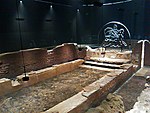
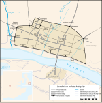
Londinium, also known as Roman London, was the capital of Roman Britain during most of the period of Roman rule. It was originally a settlement established on the current site of the City of London around AD 47–50. It sat at a key crossing point over the River Thames which turned the city into a road nexus and major port, serving as a major commercial centre in Roman Britain until its abandonment during the 5th century. Following the foundation of the town in the mid-1st century, early Londinium occupied the relatively small area of 1.4 km2 (0.5 sq mi), roughly half the area of the modern City of London and equivalent to the size of present-day Hyde Park. In the year 60 or 61, the rebellion of the Iceni under Boudica compelled the Roman forces to abandon the settlement, which was then razed. Following the defeat of Boudica by the Roman governor Gaius Suetonius Paulinus a military installation was established and the city was rebuilt. It had probably largely recovered within about a decade. During the later decades of the 1st century, Londinium expanded rapidly, becoming Britannia's largest city, and it was provided with large public buildings such as a forum and amphitheatre. By the turn of the century, Londinium had grown to perhaps 30,000 or 60,000 people, almost certainly replacing Camulodunum (Colchester) as the provincial capital, and by the mid-2nd century Londinium was at its height. Its forum-basilica was one of the largest structures north of the Alps when the Emperor Hadrian visited Londinium in 122. Excavations have discovered evidence of a major fire that destroyed much of the city shortly thereafter, but the city was again rebuilt. By the second half of the 2nd century, Londinium appears to have shrunk in both size and population. Although Londinium remained important for the rest of the Roman period, no further expansion resulted. Londinium supported a smaller but stable settlement population as archaeologists have found that much of the city after this date was covered in dark earth—the by-product of urban household waste, manure, ceramic tile, and non-farm debris of settlement occupation, which accumulated relatively undisturbed for centuries. Some time between 190 and 225, the Romans built a defensive wall around the landward side of the city. The London Wall survived for another 1,600 years and broadly defined the perimeter of the old City of London.