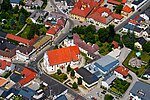
Mostviertel

Mostviertel (German: [ˈmɔstˌfɪʁtl̩] ; English: Most Quarter) is the southwestern quarter of the four quarters of Lower Austria (the northeast state of the 9 states in Austria). It is bordered on the north by the Danube and to the south and west by the state borders of Styria and Upper Austria respectively. The Wienerwald forms the natural border to the east and gives the quarter its second name, "The Quarter over the Wienerwald".The name Mostviertel comes from the term Most, which refers to the perry and cider made in the region. The lands between the Rivers Ybbs and Enns enjoy favorable conditions for growing fruit trees and are therefore the heart of a flourishing most industry. The Perry tree blossom in April is a regular highlight of the region. Typical in the Mostviertel are vast meadows of mixed orchards surrounding a farmhouse, in the center of which is usually a square courtyard, and the lightly rolling foothills of the Alps.
Excerpt from the Wikipedia article Mostviertel (License: CC BY-SA 3.0, Authors, Images).Mostviertel
Gemeinde Frankenfels
Geographical coordinates (GPS) Address Nearby Places Show on map
Geographical coordinates (GPS)
| Latitude | Longitude |
|---|---|
| N 48 ° | E 15.3333 ° |
Address
3213 Gemeinde Frankenfels
Lower Austria, Austria
Open on Google Maps


