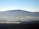
High Fichtel Mountains

The High Fichtel Mountains (German: Hohes Fichtelgebirge), or High Fichtel, form a mountainous and heavily forested range consisting of several mountain chains in the shape of a horseshoe, the Fichtel Mountain Horseshoe (Fichtelgebirgs-Hufeisen), that rings the Selb-Wunsiedel Plateau. As a natural region the High Fichtel Mountains are major unit 394 within the major unit group of the Thuringian-Franconian Highlands (39), that run from the Thuringian Forest to the Fichtel Mountains. Since September 2010 there is a new system for classifying the natural regions of northeast Bavaria, whereby the natural region of the High Fichtel only covers the central mountain region of the Scheeberg, Ochsenkopf and Kösseine, whilst the Waldstein ridge, the Steinwald and lower parts of the horseshoe represent special subordinate natural regions of the Fichtel Mountains.
Excerpt from the Wikipedia article High Fichtel Mountains (License: CC BY-SA 3.0, Authors, Images).High Fichtel Mountains
Reitschule, Vordorfer Forst
Geographical coordinates (GPS) Address Nearby Places Show on map
Geographical coordinates (GPS)
| Latitude | Longitude |
|---|---|
| N 50.05 ° | E 11.85 ° |
Address
Schneeberggipfel
Reitschule
95709 Vordorfer Forst
Bavaria, Germany
Open on Google Maps


