Bishkek (Kyrgyz: Бишкек, IPA: [biʃˈkek]; Russian: Бишкек), formerly Pishpek and Frunze, is the capital and largest city of Kyrgyzstan. Bishkek is also the administrative centre of the Chüy Region. The region surrounds the city, although the city itself is not part of the region but rather a region-level unit of Kyrgyzstan. Bishkek is situated near the border with Kazakhstan and has a population of 1,074,075, as of 2021.The Khanate of Kokand established the fortress of Pishpek in 1825 to control local caravan routes and to collect tribute from Kyrgyz tribes. On 4 September 1860, with the approval of the Kyrgyz, Russian forces led by Colonel Apollon Zimmermann destroyed the fortress. In the present day, the fortress ruins can be found just north of Jibek jolu street, near the new main mosque. A Russian settlement was established in 1868 on the site of the fortress under its original name, Pishpek. It lay within the General Governorship of Russian Turkestan and its Semirechye Oblast.
The Kara-Kirghiz Autonomous Oblast was established in 1925 in Russian Turkestan, promoting Pishpek to its capital. In 1926, the Communist Party of the Soviet Union renamed the city Frunze, after Bolshevik military leader Mikhail Frunze (1885–1925), who was born there. Frunze became the capital of the Kirghiz Soviet Socialist Republic in 1936, during the final stages of national delimitation in the Soviet Union. In 1991, the Kyrgyz parliament changed the capital's name to Bishkek.
Bishkek is situated at an altitude of about 800 metres (2,600 ft), just off the northern fringe of the Kyrgyz Ala-Too Range, an extension of the Tian Shan mountain range. These mountains rise to a height of 4,895 metres (16,060 ft). North of the city, a fertile and gently undulating steppe extends far north into neighbouring Kazakhstan. The river Chüy drains most of the area. Bishkek is connected to the Turkestan–Siberia Railway by a spur line.
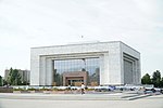
Bishkek is a city of wide boulevards and marble-faced public buildings combined with numerous Soviet-style apartment blocks surrounding interior courtyards. There are also thousands of smaller, privately built houses, mostly outside the city centre. Streets follow a grid pattern, with most flanked on both sides by narrow irrigation channels, which provide water to trees which provide shade during the hot summers.
 Continue reading on Wikipedia