place

Greater Manchester University Technical College

2014 establishments in EnglandDefunct University Technical CollegesDefunct schools in the Metropolitan Borough of OldhamEducational institutions disestablished in 2017Educational institutions established in 2014
University of BoltonUse British English from February 2023

The Greater Manchester University Technical College, branded as "The GM", was a University Technical College in Oldham, Greater Manchester, United Kingdom. The college specialised in sustainable and civil engineering and opened in September 2014. Owing to low pupil numbers and poor pupil attainment, the college closed less than three years later at the end of the 2016–17 academic year.

Excerpt from the Wikipedia article Greater Manchester University Technical College (License: CC BY-SA 3.0, Authors).

Greater Manchester University Technical College
Rochdale Road,

Geographical coordinates (GPS) Address Phone number Website Nearby Places
placeShow on map

Wikipedia: Greater Manchester University Technical CollegeContinue reading on Wikipedia

Geographical coordinates (GPS)

Latitude Longitude
N 53.5423 ° E -2.1214 °
placeShow on map

Address

The Oldham College

Rochdale Road
OL9 6AA , Coldhurst
England, United Kingdom
mapOpen on Google Maps

Phone number

call+441617854000

Website
oldham.ac.uk

linkVisit website

Share experience

Nearby Places

Oldham
Oldham

Oldham is a town in Greater Manchester, England, it lies amongst the Pennines on elevated ground between the rivers Irk and Medlock, 5 miles (8.0 km) southeast of Rochdale, and 7 miles (11.3 km) northeast of Manchester. It is the administrative centre of the Metropolitan Borough of Oldham, which had a population of 237,110 in 2019. Within the boundaries of the historic county of Lancashire, and with little early history to speak of, Oldham rose to prominence in the 19th century as an international centre of textile manufacture. It was a boomtown of the Industrial Revolution, and among the first ever industrialised towns, rapidly becoming "one of the most important centres of cotton and textile industries in England." At its zenith, it was the most productive cotton spinning mill town in the world, producing more cotton than France and Germany combined. Oldham's textile industry fell into decline in the mid-20th century; the town's last mill closed in 1998. The demise of textile processing in Oldham depressed and heavily affected the local economy. The town centre is the focus of a project that aims to transform Oldham into a centre for further education and the performing arts. It is, however, still distinguished architecturally by the surviving cotton mills and other buildings associated with that industry. In the 2011 United Kingdom census Oldham Built-up area subdivision, as defined by the Office for National Statistics, had a population of 96,555 and an area of 1,687 hectares (6.51 sq mi), giving a population density of 57.2 inhabitants per hectare (14,800/sq mi), while the Borough of Oldham had a population of 224,897, an area of 14,236 hectares (54.97 sq mi), and a population density of 15.8 inhabitants per hectare (4,100/sq mi).

Westwood, Greater Manchester

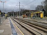
Westwood is an urban area of Oldham, in Greater Manchester, England. It occupies a hillside known as North Moor in the western part of Oldham, close to its boundary with Royton and Chadderton. Westwood, which has no formal boundary or extent, is bisected by the A6048 road . Historically a part of Lancashire, Westwood was formerly an electoral ward of the County Borough of Oldham, but is now split between the wards of Coldhurst and Werneth, which lie to the north and south respectively. Apart from its industrial and commercial units, Westwood's built environment is "almost entirely" composed of Victorian era terraces, with some small pockets of housing association and council house properties.The Metropolitan Borough of Oldham has the largest population of Bangladeshis in the United Kingdom outside of London. Sixty percent of the borough's Bangladeshi community live in Westwood. Most of them immigrated from the Sylhet Division of Bangladesh. Westwood features a replica of the Shaheed Minar national monument, which commemorates those killed in the Bengali Language Movement demonstrations in 1952.In the 1980s, unemployment in Westwood experienced a "massive increase", significantly higher than the "modest increase" seen in Oldham as a whole. Ethnicity was attributed as a factor.Westwood Moravian Church congregation was founded in 1865. A church building for the congregation dating from 1869 still stands in the locality. The congregation now worships in Royton. Winston Churchill frequented Westwood's Conservative club. Churchill orated at the club during his period as Member of Parliament for Oldham.Westwood Primary is a primary school located in the area.Westwood Metrolink station opened in 2012 in Phase 3b of the Manchester Metrolink extension. It was funded by the Greater Manchester Transport Innovation Fund.The Greater Manchester Waste Disposal Authority operate a transfer loading station at Westwood Industrial Estate. Anchor Retail Park occupies Anchor Mill, a former cotton mill.

Coldhurst
Coldhurst

Coldhurst (or more rarely Cold Hurst) is an area of Oldham and an electoral ward of the wider Metropolitan Borough of Oldham in Greater Manchester, England. At the time of the United Kingdom Census 2001, it had a population of 11,935, increasing to 13,201 at the 2011 Census. The electoral ward spans most of Oldham's town centre, although the name Coldhurst conventionally applies to the area immediately north of the centre. The district of Westwood and a small adjoining part of Chadderton in the Busk area also lie within the Coldhurst ward district. Historically a part of Lancashire, Coldhurst was formerly a chapelry within the ancient ecclesiastical parish of Prestwich-cum-Oldham, in the Salfordshire hundred.An old hall existed in the locality belonging to Abram Crompton Esq, which gave its name to Crompton Street. Coldhurst is said to have been the scene of an action in the English Civil War in which the parliamentarians were defeated.Following the Industrial Revolution, Coldhurst was the site of considerable industry and commerce, including coal mining, cotton spinning and hat manufacture.Coldhurst is the home of a significant community of South Asian (particularly Bangladeshi) heritage. 37% of the population is non-white and most of the white residents live in what have been described as "bleak council developments". In 2001, Coldhurst was in the 5% most deprived wards in the United Kingdom.A photograph of Coldhurst during the Victorian era was used as part of the "Made of Manchester" promotion of the home strip worn by Manchester United F.C. for the 2012–13 season.