Doeville, Tennessee
Unincorporated communities in Johnson County, TennesseeUnincorporated communities in TennesseeUse mdy dates from July 2023Vague or ambiguous geographic scope from June 2023

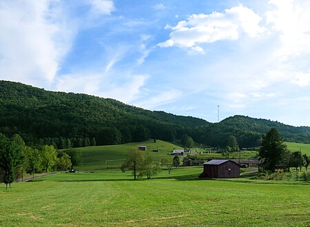
Doeville is an unincorporated community in Johnson County, Tennessee. It is concentrated around the intersection of Tennessee State Route 67 and Tennessee State Route 167, west of Mountain City and east of Butler. The community of Pandora lies immediately to the northeast along S.R. 67. Doeville is situated in the lower Doe Creek Valley, near the stream's confluence with Roan Creek at the headwaters of Watauga Lake. It is surrounded by mountains on all sides, namely Sink Mountain to the south, Doe Mountain to the east, and the Iron Mountains to the north and west. The Johnson County Airport is located nearby.
Excerpt from the Wikipedia article Doeville, Tennessee (License: CC BY-SA 3.0, Authors, Images).Doeville, Tennessee
State Route 67,
Geographical coordinates (GPS) Address Show on map
Geographical coordinates (GPS)
| Latitude | Longitude |
|---|---|
| N 36.389444444444 ° | E -81.969722222222 ° |
Address
State Route 67 11911
37640
Tennessee, United States
Open on Google Maps