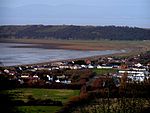
Sand Point and Middle Hope

Sand Point in Somerset, England, is the peninsula stretching out from Middle Hope, an 84.1-hectare (208-acre) biological and geological Site of Special Scientific Interest. It lies to the north of the village of Kewstoke, and the stretch of coastline called Sand Bay north of the town of Weston-super-Mare. On a clear day it commands views over Flat Holm, of the Bristol Channel, South Wales, Clevedon, the Second Severn Crossing and the Severn Bridge. A line drawn between Sand Point and Lavernock Point in South Wales marks the lower limit of the Severn Estuary and the start of the Bristol Channel. Middle Hope is a sequence of carboniferous limestone with unusual geological features including a Pleistocene-aged fossil cliff and as a result has been designated as a regionally important geological site. The underlying geology and soil types support scarce plants such as the smallflower buttercup, honewort, Cheddar pink and Somerset hair grass. Human use of the sites is shown by a bowl barrow and disc barrow from late Neolithic or Bronze Age and the site of a likely motte-and-bailey castle. Woodspring Priory, a former Augustinian priory which was founded in the early 13th century, sits just inland of the rocky promontory. The priory and surrounding land is owned by the National Trust and is a popular place for walking.
Excerpt from the Wikipedia article Sand Point and Middle Hope (License: CC BY-SA 3.0, Authors, Images).Sand Point and Middle Hope
Geographical coordinates (GPS) Address Nearby Places Show on map
Geographical coordinates (GPS)
| Latitude | Longitude |
|---|---|
| N 51.39081 ° | E -2.9715 ° |
Address
Kewstoke
England, United Kingdom
Open on Google Maps


