Arrondissement of Saint-Pierre, Réunion
Arrondissements of RéunionRéunion geography stubs

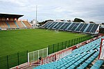
The arrondissement of Saint-Pierre is an arrondissement of France in the Réunion department in the Réunion region. It has 10 communes. Its population is 311,401 (2019), and its area is 942.8 km2 (364.0 sq mi).
Excerpt from the Wikipedia article Arrondissement of Saint-Pierre, Réunion (License: CC BY-SA 3.0, Authors, Images).Arrondissement of Saint-Pierre, Réunion
Rue Victor le Vigoureux, Saint-Pierre
Geographical coordinates (GPS) Address Nearby Places Show on map
 Continue reading on Wikipedia
 Geographical coordinates (GPS)
| Latitude | Longitude |
|---|---|
| N -21.338611111111 ° | E 55.474722222222 ° |
Address
Ancien tribunal
Rue Victor le Vigoureux 60
97410 Saint-Pierre, La Ravine Blanche
Réunion, France
Open on Google Maps