place

Rehoboth Bay

Bays of DelawareBays of Sussex County, DelawareDelaware geography stubsIntracoastal Waterway
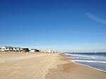
Head of Rehoboth Bay, near Rehoboth Beach, Del (63080)

Rehoboth Bay is a body of water in Sussex County, Delaware. It is connected to the Broadkill River by the Lewes and Rehoboth Canal. It is part of Delaware's inland bay system, along with Little Assawoman Bay and Indian River Bay. Of Delaware's Inland Bays, both Rehoboth Bay and Little Assawoman Bay are barbuilt estuaries, while Indian River Bay is a drowned river valley. Rehoboth Bay is the northernmost of Delaware's inland bays. Its depth is generally shallow, less than 6 to 7 feet below Mean Lower Low Water. The surface area of the bay is approximately 13 square miles. Rehoboth Bay receives fresh water discharges from a number of small creeks along the bay, including White Oak Creek, Love Creek, Herring Creek, and Guinea Creek. Rehoboth Bay is linked to Indian River Bay to the south, providing tidal exchange with the Atlantic Ocean through Indian River Inlet, which is stabilized by two parallel stone jetties. At the north end of the Bay, the Lewes-Rehoboth Canal connects Rehoboth Bay to the Delaware Bay as part of the Intracoastal Waterway. Tidal flow provides some exchange of water between the Delaware Bay and Rehoboth Bay through the canal.

Excerpt from the Wikipedia article Rehoboth Bay (License: CC BY-SA 3.0, Authors, Images).

Geographical coordinates (GPS)

Latitude Longitude
N 38.664083333333 ° E -75.1045 °
placeShow on map

Address

Sussex County


Delaware, United States
mapOpen on Google Maps

Head of Rehoboth Bay, near Rehoboth Beach, Del (63080)
Share experience

Nearby Places

Indian River Life-Saving Station

The Indian River Life-Saving Station was established at Rehoboth Beach, Delaware in 1876 to rescue mariners shipwrecked along the Delaware coast, as part of the United States Life-Saving Service. It was designed in 1874 as a 1+1⁄2-story board-and-batten frame structure with decorative brackets supporting overhanging eaves in a version of the Queen Anne style. It sheltered a surfboat which could be quickly rolled out through double doors facing the beach and down a ramp to the water. The main station house remains of what was once a complex that included a barn, stable, meat house, feed house and privy. An auxiliary boathouse stood about a mile to the south. The original plans for the station survive.The facility was moved back from the water's edge in 1877 due to coastal erosion. In 1915, the United States Life-Saving Service merged with the Revenue Cutter Service to form the United States Coast Guard. The station was converted to a Coast Guard station and occupied until the Ash Wednesday Storm of 1962, which left it partially buried in sand. A new Coast Guard station was built nearby in 1964. The original station was restored by the Delaware Seashore Preservation Foundation, and is now operated as the Indian River Life-Saving Station Museum by Delaware State Parks, as part of Delaware Seashore State Park.The Indian River Life Saving Service Station was placed on the National Register of Historic Places on September 29, 1976.