place

Northampton Veterans Affairs Medical Center

Buildings and structures in Northampton, MassachusettsGovernment buildings completed in 1924Historic districts on the National Register of Historic Places in MassachusettsHospital buildings completed in 1924Hospitals in Hampshire County, Massachusetts
NRHP infobox with nocatNational Register of Historic Places in Hampshire County, MassachusettsUse mdy dates from August 2023
NorthamptonMA VA Housing

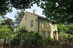
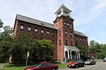
The Northampton Veterans Affairs Medical Center, formerly the Northampton Veterans Administration Hospital, is a facility of the United States Department of Veterans Affairs (VA) at 421 Main Street in the Leeds section of northern Northampton, Massachusetts. Its campus once consisted of about 286 acres (116 ha) of land, which had by 2012 been reduced to 105 acres (42 ha). The hospital was opened in 1924 to treat neuropsychiatric patients, but now provides a wider array of medical services. In 2012 the remaining 105 acre campus was listed as a historic district on the National Register of Historic Places. The district includes the main hospital buildings, as well as residential housing, utility and maintenance buildings, most of which were built no later than 1947, and some of which date to 1922, the earliest period of the facility's construction. It is an excellent example of an intact Period 1 neuropsychiatric VA hospital, and was the first VA hospital in Massachusetts.

Excerpt from the Wikipedia article Northampton Veterans Affairs Medical Center (License: CC BY-SA 3.0, Authors, Images).

Northampton Veterans Affairs Medical Center
North Main Street, Northampton

Geographical coordinates (GPS) Address Phone number Website Nearby Places
placeShow on map

Wikipedia: Northampton Veterans Affairs Medical CenterContinue reading on Wikipedia

Geographical coordinates (GPS)

Latitude Longitude
N 42.349722222222 ° E -72.681666666667 °
placeShow on map

Address

VA Medical Center

North Main Street 421
01053 Northampton
Massachusetts, United States
mapOpen on Google Maps

Phone number
Veterans Health Administration

call+1(413)5844040

Website
centralwesternmass.va.gov

linkVisit website

NorthamptonMA VA Housing
Share experience

Nearby Places

Leeds, Massachusetts

Leeds is a village in the western portion of the city of Northampton, Massachusetts, United States, bordering Williamsburg—along the Mill River—and Florence. The ZIP Code for Leeds is 01053.The village was named after the city of Leeds, in England. In the 19th century, Leeds was known for its textile manufacturing, including broadcloth, silk, and vegetable ivory buttons, as well as extensive manufacturing of farm implements and household goods. The major producer of silk in Leeds was the Corticelli Silk Mills, which were owned by the Nonotuck Silk Company. They had several buildings along sections of the Mill River. The major factory was located at the corner of Main Street and Mulberry Street, another factory building was located across the bridge and to the right of Chartpak. Another building was located near the opposite end of Main Street, where the cocoons were steamed to loosen the fibers and made the raw silk usable for production in Corticelli's various products. The company also created items that could be used in the classroom as teaching aids, including a poster showing the various steps in the production of silk. In 1874, a dam on the Mill River broke, flooding Leeds and Williamsburg and killing 139 people. Today, Leeds is home to the Northampton Veterans Affairs Medical Center, and Chartpak, manufacturer of art and graphics supplies, which includes Koh-i-Noor Hardtmuth. Leeds is also home to Leeds Elementary School.