Wachtberg
Cologne region geography stubsMunicipalities in North Rhine-Westphalia

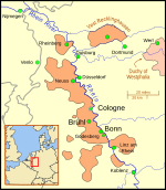
Wachtberg is a municipality in the Rhein-Sieg district, of North Rhine-Westphalia, Germany. It is situated approximately 15 km south of Bonn. In 2021 the Wachtberg municipality had approximately 20,352 inhabitants. The municipality was formed 1969 as a merger of 13 now incorporated villages. The town-hall is in the village of Berkum, approximately in the center of the area. The Rodderberg mountain is in the east of the Wachtberg district. The municipality is named after another volcanic mountain, the Wachtberg, (extinct for 25 million years, now with a height of 258 m) that is situated near the centre of the municipality.
Excerpt from the Wikipedia article Wachtberg (License: CC BY-SA 3.0, Authors, Images).Wachtberg
Fraunhoferstraße,
Geographical coordinates (GPS) Address Nearby Places Show on map
Geographical coordinates (GPS)
| Latitude | Longitude |
|---|---|
| N 50.616666666667 ° | E 7.1333333333333 ° |
Address
Fraunhoferstraße
Fraunhoferstraße
53343
North Rhine-Westphalia, Germany
Open on Google Maps


