place

Great Weigh House

Buildings and structures in KrakówFormer buildings and structures in PolandTourist attractions in Kraków
Sukiennice plus wielka waga

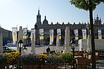
The Great Weigh House (Polish: Wielka Waga Miejska) was a prominent building that existed on the main square of Kraków, Poland. It was located in between the Cloth Hall (Sukiennice) and Church of St. Adalbert to the east. Next to it was the Small Weigh House.

Excerpt from the Wikipedia article Great Weigh House (License: CC BY-SA 3.0, Authors, Images).

Great Weigh House
Plac Mariacki, Krakow Stare Miasto (Old Town)

Geographical coordinates (GPS) Address Nearby Places
placeShow on map

Wikipedia: Great Weigh HouseContinue reading on Wikipedia

Geographical coordinates (GPS)

Latitude Longitude
N 50.0611 ° E 19.9375 °
placeShow on map

Address

Rynek Główny

Plac Mariacki
31-013 Krakow, Stare Miasto (Old Town)
Lesser Poland Voivodeship, Poland
mapOpen on Google Maps

Sukiennice plus wielka waga
Share experience

Nearby Places

Kraków
Kraków

Kraków (Polish: [ˈkrakuf] (listen)), also known in English as Cracow, is the second-largest and one of the oldest cities in Poland. Situated on the Vistula River in Lesser Poland Voivodeship, the city dates back to the seventh century. Kraków was the official capital of Poland until 1596 and has traditionally been one of the leading centres of Polish academic, economic, cultural and artistic life. Cited as one of Europe's most beautiful cities, its Old Town with Wawel Royal Castle was declared the first UNESCO World Heritage Site in the world. The city has grown from a Stone Age settlement to Poland's second-most-important city. It began as a hamlet on Wawel Hill and was reported as a busy trading centre of Central Europe in 965. With the establishment of new universities and cultural venues at the emergence of the Second Polish Republic in 1918 and throughout the 20th century, Kraków reaffirmed its role as a major national academic and artistic centre. The city has a population of about 780,000, with approximately 8 million additional people living within a 100 km (62 mi) radius of its main square.After the invasion of Poland by Nazi Germany at the start of World War II, the newly defined Distrikt Krakau (Kraków District) became the capital of Germany's General Government. The Jewish population of the city was forced into a walled zone known as the Kraków Ghetto, from where they were sent to Nazi extermination camps such as the nearby Auschwitz, and Nazi concentration camps like Płaszów. However, the city was spared from destruction and major bombing. In 1978, Karol Wojtyła, archbishop of Kraków, was elevated to the papacy as Pope John Paul II—the first non-Italian pope in 455 years. Also that year, UNESCO approved Kraków's entire Old Town and historic centre as its first World Heritage Site alongside Quito. Kraków is classified as a global city with the ranking of "high sufficiency" by the Globalization and World Cities Research Network. Its extensive cultural heritage across the epochs of Gothic, Renaissance and Baroque architecture includes Wawel Cathedral and Wawel Royal Castle on the banks of the Vistula, St. Mary's Basilica, Saints Peter and Paul Church and the largest medieval market square in Europe, Rynek Główny. Kraków is home to Jagiellonian University, one of the oldest universities in the world and traditionally Poland's most reputable institution of higher learning. In 2000, Kraków was named European Capital of Culture. In 2013, Kraków was officially approved as a UNESCO City of Literature. The city hosted World Youth Day in July 2016.

Kraków Old Town
Kraków Old Town

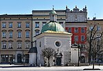
Kraków Old Town is the historic central district of Kraków, Poland. It is one of the most famous old districts in Poland today and was the centre of Poland's political life from 1038 until King Sigismund III Vasa relocated his court to Warsaw in 1596. The entire medieval old town is among the first sites chosen for the UNESCO's original World Heritage List, inscribed as Cracow's Historic Centre. The old town is also one of Poland's official national Historic Monuments (Pomnik historii) chosen in the first round, as designated 16 September 1994, and tracked by the National Heritage Board of Poland. The Old Town is known in Polish as Stare Miasto. It is part of the city's first administrative district which is also named "Stare Miasto," although it covers a wider area than the Old Town itself. Medieval Kraków was surrounded by a 3 km (1.9 mi) defensive wall complete with 46 towers and seven main entrances leading through them. The fortifications around the Old Town were erected over the course of two centuries. The current architectural plan of Stare Miasto – the 13th-century merchants' town – was drawn up in 1257 after the destruction of the city during the Tatar invasions of 1241 followed by raids of 1259 and repelled in 1287. The district features the centrally located Rynek Główny, or Main Square, the largest medieval town square of any European city. There is a number of historic landmarks in its vicinity, such as St. Mary's Basilica (Kościół Mariacki), Church of St. Wojciech (St. Adalbert's), Church of St. Barbara, as well as other national treasures. At the centre of the plaza, surrounded by kamienice (row houses) and noble residences, stands the Renaissance cloth hall Sukiennice (currently housing gift shops, restaurants and merchant stalls) with the National Gallery of Art upstairs. It is flanked by the Town Hall Tower (Wieża ratuszowa). The whole district is bisected by the Royal Road, the coronation route traversed by the Kings of Poland. The Route begins at St. Florian's Church outside the northern flank of the old city walls in the medieval suburb of Kleparz; passes the Barbican of Kraków (Barbakan) built in 1499, and enters Stare Miasto through the Florian Gate. It leads down Floriańska Street through the Main Square, and up Grodzka to Wawel, the former seat of Polish royalty overlooking the Vistula river. In the 19th century most of the Old Town fortifications were demolished. The moat encircling the walls was filled in and turned into a green belt known as Planty Park.