Crestwood, Queanbeyan
Localities in New South WalesQueanbeyanSouthern Tablelands geography stubsUse Australian English from August 2019

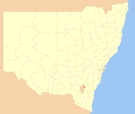
Crestwood is a suburb of Queanbeyan, New South Wales, Australia. Crestwood is located west of the central business district (CBD) to the west of Ross Road and the north of Canberra Avenue and also borders the Australian Capital Territory. At the 2021 census, it had a population of 4,936.
Excerpt from the Wikipedia article Crestwood, Queanbeyan (License: CC BY-SA 3.0, Authors, Images).Crestwood, Queanbeyan
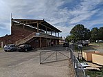
Richard Avenue, Queanbeyan Crestwood
Geographical coordinates (GPS) Address Website Nearby Places Show on map
Geographical coordinates (GPS)
| Latitude | Longitude |
|---|---|
| N -35.34832 ° | E 149.21609 ° |
Address
West Queanbeyan Primary School (Queanbeyan West Public School)
Richard Avenue
2620 Queanbeyan, Crestwood
New South Wales, Australia
Open on Google Maps


