place

Kootwijkerbroek

Barneveld (municipality)Populated places in Gelderland
GG Kootwbr achter
GG Kootwbr achter

Kootwijkerbroek is a village in the Netherlands, on the Veluwe, in the municipality of Barneveld, Gelderland, Netherlands. The village, situated in the Gelderland Valley, east of Barneveld, has a major agricultural role in this part of the valley with most of the 157 companies located in Kootwijkerbroek involved in agriculture and industry. Kootwijkerbroek is an old village just between Kootwijk and Barneveld, with many generations traditionally involved in milling. The last mill burnt down in 1964, however it was rebuilt in 2015. On the edge of the village, there is a church with a beautiful old vicarage surrounded by an attractive garden park with ponds. Kootwijkerbroek is a conservative Protestant village, located on the Dutch Bible Belt. In the 2010 municipal elections, 52 percent of the local population voted for the Reformed Political Party (SGP). The three Christian parties in the elections (the Reformed Political Party, the ChristianUnion and the Christian Democratic Appeal) had a combined total of almost 70 percent of the votes. Many of the socio demographic indicators reflect the conservative nature of the community, with relatively larger household families with young children and low divorce rates.Hundreds of farmers protested in 2001 in the village of Kootwijkerbroek. They tried to prevent the slaughter of healthy cattle as a result of foot-and-mouth disease restrictions. The farmers never accepted the verdict by the authorities that the disease had spread to the 'Teunissen' farm, as the alleged outbreak never spread beyond the suspected veal calf operation. In every other outbreak location in 2001, other surrounding farms were infected with animals showing evidence of the infection. The blockade involved about 200 farmers and was the largest protest related to the foot-and-mouth epidemic in the Netherlands.

Excerpt from the Wikipedia article Kootwijkerbroek (License: CC BY-SA 3.0, Authors, Images).

Kootwijkerbroek
Beldmolenstraat, Barneveld

Geographical coordinates (GPS) Address Nearby Places
placeShow on map

Wikipedia: KootwijkerbroekContinue reading on Wikipedia

Geographical coordinates (GPS)

Latitude Longitude
N 52.15 ° E 5.6666666666667 °
placeShow on map

Address

Beldmolenstraat 1
3774 CW Barneveld
Gelderland, Netherlands
mapOpen on Google Maps

GG Kootwbr achter
GG Kootwbr achter
Share experience

Nearby Places

Muur van Mussert
Muur van Mussert

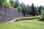
The Muur van Mussert ("wall of Mussert") is all that remains of a rally ground with buildings and monuments planned by Anton Mussert and his National Socialist Movement in the Netherlands (NSB) to house party meetings and hold national events to celebrate national-socialist thought in the Netherlands. The wall was built in 1938, on a plot of land the NSB had acquired near Lunteren in Gelderland, in the center of the country, and was inspired by the Nazi party rally grounds in Nuremberg.Between 1936 and 1940, the NSB organized annual Hagespraken at the location, open-air propaganda meetings based on a supposed Germanic ideal and modeled after similar meetings in Germany. The place was visited by tens of thousands of NSB members, though the atmosphere was more that of a boy scout jamboree. One of the speakers at the (last) meeting on 22 June 1940 was Adriaan van Hees, who called for vengeance for the death of eight NSB members who had been executed during the German invasion of May 1940. After 1940, mass gatherings of a political kind were forbidden by the German occupying forces; after the war, the wall fell into disrepair. As of 2015 the wall, overgrown in places, is little more than a boundary for a local campground; the masonry is crumbling and the associated buildings are ruined. In the early 2000s, the municipality of Ede wanted to have the wall declared a monument but backtracked, after protests by war veterans and others (including the Centrum Informatie en Documentatie Israël (CIDI), an organization founded by the Dutch Jewish community), some of whom feared that the place would become a gathering point for the extreme right. In the 2010s, the wall again attracted attention in the media, prompted by the publication of De muur van Mussert (Boom, 2015) by Rene van Heijningen, a historian associated with the NIOD Institute for War, Holocaust and Genocide Studies.

Voorthuizen
Voorthuizen

Voorthuizen (Dutch Low Saxon: Voorthuzen) is a village in the municipality of Barneveld, in the Dutch province of Gelderland. Voorthuizen was founded, according to legend, near a crossing of a ford ('Voorde') of the Ganzenbeek, a brook that no longer exists, on the road from Amsterdam to Deventer. This road was called a "Hessenweg" ('Hessian road') because seasonal labourers from Westphalia would travel along this road into the Netherlands. Another important road that lead through this place was the trade route from Harderwijk to Wageningen. This made Voorthuizen an important stop along these two routes. A new high road was commissioned and built by King Louis Bonaparte in 1809, which actually divided up the village. During the 20th century, traffic along this route through the centre of the village increased, and a new main road was built in 1972, south of the village. Voorthuizen was a separate municipality between 1812 and 1818.Near the end of World War II, many buildings in the village were heavily damaged due to an engagement between Canadian and German troops on 16-17 April 1945. In 1999, the Seaforth Highlanders of Holland pipe and drum band was founded to commemorate the liberation of the village in 1945 by the Seaforth Highlanders of British Columbia. Due to the increase of the military after the war, the number of military bases and garrisons was rapidly expanded, among others the nearby military base "De Wittenberg" in Garderen/Stroe (renamed Generaal Majoor Koot Kazerne in 1978), and a mobilization complex at the Garderbroekerweg in Voorthuizen. The influx of military personnel led to the expansion of the village in the early 1950s; one of these new neighborhoods that housed many servicemen -located according to rank,- soon was nicknamed "Klein Korea" ('Little Korea'). These new inhabitants, and others that followed, lead to a shift in the population, from traditional agricultural labourers to a broader oriented populace, making Voorthuizen one of the more progressive villages in the municipality.