place

Gwydir Forest

Betws-y-CoedBro MachnoCapel CurigDolwyddelanForests and woodlands of Conwy County Borough
Forests and woodlands of SnowdoniaRally GBTourist attractions in Conwy County BoroughTrefriw
View from Gwydir Forest

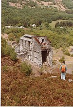
Gwydir Forest, also spelled Gwydyr, is located in Conwy county borough and the Snowdonia National Park in Wales. It takes its name from the ancient Gwydir Estate, established by the John Wynn family of Gwydir Castle, which owned this area. Natural Resources Wales uses the alternative spelling (i.e. Gwydyr Forest, Coedwig Gwydyr). Certainly as early as 1536, Leland wrote: "Gwydir lieth two bowshots above the River Conwy. It is a pretty place."

Excerpt from the Wikipedia article Gwydir Forest (License: CC BY-SA 3.0, Authors, Images).

Gwydir Forest
Hafna Mine No3 Level,

Geographical coordinates (GPS) Address Nearby Places
placeShow on map

Wikipedia: Gwydir ForestContinue reading on Wikipedia

Geographical coordinates (GPS)

Latitude Longitude
N 53.126 ° E -3.828 °
placeShow on map

Address

Hafna Mine No3 Level

Hafna Mine No3 Level
LL27 0JB , Trefriw
Wales, United Kingdom
mapOpen on Google Maps

View from Gwydir Forest
Share experience

Nearby Places

Grey Mare's Tail, Conwy

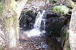
The Grey Mare's Tail (Welsh: Rhaeadr y Parc Mawr) is a waterfall on the very edge of the Snowdonia National Park near Gwydir Castle in the county of Conwy, north Wales. It lies just off the B5106 road between the town of Llanrwst and the large village of Trefriw. The Welsh name, Rhaeadr y Parc Mawr, derives from the fact that the falls are fed by a large stream that has its source in the Gwydir Forest, and flows through the old Parc Mine, about a mile to the southeast. The name 'Grey Mare's Tail' was given to it by Lady Willoughby of Gwydir Castle, possibly "in compliment to Lord Byron and the Staubbach" (Byron compared the 900 ft Staubbach Falls in Switzerland to the long white tail of the pale horse upon which death is mounted in the Book of Revelation.)In all there are some ten types of waterfall, a horsetail being described as a fall where the descending water maintains some contact with bedrock. Despite its name, this waterfall actually comprises two cascades, the water flowing around both sides of a large rock at the top. However this was possibly not always the case — in 1895 Francis Frith published a postcard showing the "White Mare's Tail Cascade, Llanrwst". Despite the slightly different name ('white') and only showing a single waterfall — as opposed to today's twin cascades — it is probable from the woodland setting that this is indeed the same location. Below the falls is a shallow plunge pool, and on leaving the wood the waters flow under the road to join eventually the River Conwy. The woodland area in which the falls lie is known as Coed Felin Blwm ("Lead Mill Wood"), and the remains of mill buildings can be seen near the falls. Felin Blwm lead mill (a name now taken by the adjacent house) was originally erected by the Gwydir Estate to crush ore from Parc Mine in the Gwydir Forest and it is possible that this is the mill listed in surviving 18th-century Estate accounts. A later decline in lead mining saw the mill converted to a sawmill. Both lead and wood from this site was transported down the River Conwy from Trefriw. The waters of the falls are not especially pure because of the minerals (not just lead) in the rocks of the Gwydir Forest. When Sir John Wynn was laying out the ornamental gardens at Gwydir Castle in the 1590s, he took a spur of water from above the falls, channelling it along the hillside in a leat. Collected in a header tank, from here the water was of sufficient pressure to feed the fountain in the gardens. This still functions today.In her book Castles in the Air, the current owner of Gwydir Castle describes the waterfall thus: No need to improve on the imagery of the Grey Mare's Tail. Suffice it to say, the cascade of water fell from a high point to a low point in a secluded little dell not far from the castle, like a grey mare's tail. The spray from it was bracing even in summer. It had the feel of water that lived most of its life under ground. The area around the falls is now a nature reserve, owned by Natural Resources Wales, as is much of the adjacent Gwydir Forest. There is a tiny signed car park at the gate, but otherwise the existence of the falls is not signed at all, and remains unknown to many who pass by. The falls can also be reached from above, from the lane which leads up to the hamlet of Llanrhychwyn.

Llyn Geirionydd
Llyn Geirionydd

Llyn Geirionydd lies in a valley in northern Wales where the northern edge of the Gwydyr Forest meets the lower slopes of the Carneddau mountains. The lake is almost a mile long and covers an area of 45 acres (180,000 m2), but is never any deeper than 50 ft (15 m) according to Jehu's survey. The lake can be reached by car from Trefriw or Llanrwst in the Conwy valley, the lane passing through the hamlet of Llanrhychwyn, or from the road through the Gwydir Forest. Access is not particularly easy by either route, but this has not stopped the lake being the only one designated in Snowdonia to permit power boats and water skiing. Many visitors also walk to the lake from the village of Trefriw (it is on one of the Trefriw Trail routes) or from the neighbouring lake of Llyn Crafnant, which runs parallel to it, but a mile distant, the two being separated by Mynydd Deulyn, “mountain of the two lakes”. The lake has a car park (with toilets) and the location is very popular in the summer. This car park was once a waste tip site for the Pandora mine above, and indeed the planting of conifers in the area of the lake has considerably softened the effects of mining. There are few, if any, fish in the lake, and this, it is believed, is the result of the poisoning of the waters from the adjacent metal mines. Afon Geirionydd, the outflow of Llyn Geirionydd, flows down a steep gorge—Geirionydd Gorge—which is popular for gorge walking. At the bottom of this gorge are the remains of Klondyke mill, which was powered by water from the river. This mill, apart from processing its own metals (which did not amount to much), also received lead and zinc ore from the Pandora mine, and the route of the tramway from that mine ran partly along the route of the lakeside road (which did not exist at the time), and can be clearly seen running between the road and the lake along the northern half of the lake where the road rises somewhat. This tramway continues to a point above Klondyke mill, from where wagons entered the mine via an aerial ropeway. This last part of the tramway is a right of way which runs above the valley, eventually reaching Trefriw. Below Klondyke Mill Afon Geirionydd joins Afon Crafnant, the outflow from neighbouring Llyn Crafnant, which itself is a tributary of the River Conwy. The current road follows what some believe to be part of Sarn Helen, the Roman road which ran southwards from the fort at Canovium (Caerhun, between Trefriw and Conwy) to the fort at Tomen y Mur (near Trawsfynydd), and beyond, ultimately reaching Moridunum (Carmarthen). The nearest settlement to Llyn Geirionydd is the hamlet of Llanrhychwyn, which has connections with Llywelyn Fawr, a Welsh prince, who had a hunting lodge in Trefriw, but who used Llanrhychwyn church, regarded by many to be the oldest church in Wales. Llyn Geirionydd has a number of literary connections: Ieuan Glan Geirionydd (1795–1855) was born on the banks of Afon Geirionydd, and he was renowned for his poetry and hymns. Taliesin (c. 534–c.599), was a 6th-century Welsh bard, and the earliest poet of the Welsh language whose work has survived. He was an inhabitant of the area, living on the shores of Llyn Geirionydd, and this is also where many say he is buried. The Red Book of Hergest XVII contains the line "I being Taliesin, from the borders of the lake of Geirionnydd." Some sources claim that he was also born in this area, but it is more likely that he was born in Powys, as demonstrated by the contemporary poems to Cynan Garwyn, King of Powys. John Roberts (1828–1904) was a native of neighbouring Trefriw, and he used that name in his job as a printer and bookseller. In Eisteddfodau he would assume the bardic name of Gwilym Cowlyd. He was critical of the Anglicization of the Eisteddfodau and in 1865 he founded a separate festival to rival the big National Eisteddfod, and called it Arwest Glan Geirionydd (‘Music Festival on the Banks of the River Geirionydd’), and the meeting point was Bryn y Caniadau (hill of verse). The Taliesin Memorial by Llyn Geirionydd commemorates these Eisteddfodau, although the memorial is not actually on Bryn y Caniadau itself (which is a little further back from the lake). David Francis (1865–1929) made his name as “The Blind Harpist of Meirion” at these alternative Eisteddfodau.

Fairy Falls, Trefriw

The Fairy Falls (Welsh: Rhaeadr y Tylwyth Teg) is a waterfall in the village of Trefriw, north Wales. The falls are on the river Crafnant which has its source at Llyn Crafnant, being joined upstream by a tributary, the river Geirionydd. Below the falls the river Crafnant flows on to itself become a tributary of the river Conwy. The main falls are about 25 feet high, the water falling down an angled rockface, and they were formed during the last ice age some 20,000 years ago. As the main glacier passed down the Conwy Valley, it truncated the Crafnant valley, leaving a hanging valley and this series of falls.Not all of the water from the river Crafnant passes over the falls, as a little upstream some is diverted through a pipeline to provide hydro-electric power for the woollen mill. During drier periods this can leave the falls with little or even no water, but most of the year there is a good supply of water, as testified by the erosion of the rocks at the base of the falls. Downstream of the main Fairy Falls are a number of further, lesser, falls, which old postcards also call the "Fairy Falls". Along this lower section of river the water once turned a number of waterwheels which powered various mills. The whole area of this series of falls—from the main falls through the lesser falls downstream—was known as "Fairy Glen", and was altogether more open than it is today. In Edwardian times there was a proper path alongside the river Crafnant, and a popular stroll was to walk from the banks of the river Crafnant, up through the well-known Fairy Glen, and on beside the river Crafnant up towards Llyn Crafnant.Regarding the name, the information board beside the waterfall states: "The Trefriw Fairy Falls were named by the Victorians who were fascinated with fairies and identified many enchanting locations as home to these diminutive, mythical creatures." Whilst there are no documented sightings of fairies at the falls themselves, in 1880 Wirt Sikes referred to numerous local sightings of fairies in his book British Goblins—Welsh Folk-lore, Fairy Mythology, Legends and Traditions.The Fairy Falls pub in the village takes its name from the Falls. The Falls are easily accessible on foot from various directions, and are on the route of one of the Trefriw Trails, a series of walks around the village and adjacent areas. Route 4, starting from the village shops, follows the riverside path through Fairy Glen and past the falls. Route 5 also takes this route before heading on to Llyn Geirionydd and Llyn Crafnant.

Trefriw
Trefriw

Trefriw (Welsh pronunciation: [trɛˈvrɪu]) is a village and community in Conwy County Borough, Wales. It lies on the river Crafnant a few miles south of the site of the Roman fort of Canovium, sited at Caerhun. At the last three censuses, the population of the community has been recorded as 842 in 1999, 915 in 2001, and 783 in 2011 (from a total of 368 households).Trefriw lies on the edge of Snowdonia, on the B5106 road to the north-west of Llanrwst, and about 4½ miles north of Betws-y-Coed by road. It is located on the western slopes of the glaciated Conwy valley, below the ridge of Cefn Cyfarwydd, the village having been largely built in a semicircle at the point where the river Crafnant flows from its hanging valley to join the river Conwy. The river Crafnant still provides power for the woollen mill, and in the past provided power for a number of other industries based along its banks, such as a forge which provided quarry tools. The community includes the hamlet of Llanrhychwyn. Most of the village lies within the Snowdonia National Park, the boundary running down the main street of the village. Apart from its reputation as a good starting point for walks (the village has Walkers are Welcome status and stages an annual walking festival), Trefriw is today mostly known for its woollen mill, and for the nearby chalybeate spa, first known to have been used by the Romans and further developed in about 1700. Its waters were one of very few throughout Europe to have been classified as a medicine due to their high iron content.