place

Longforth Farm

Archaeological sites in SomersetWellington, Somerset
Longforth 12 july 2013 7

Longforth Farm, on the outskirts of Wellington, Somerset, England, is the site of a Bronze Age landscape and an extensive medieval structure.The previously unknown site, which covers 0.4 hectares (0.99 acres), was uncovered during excavations in 2013 prior to the building of 500 new houses by Bloor Homes.The stone foundations, which are covered in decorated tiles are laid out around courtyards. The remains of roof slates and glazed ceramic roof tiles have also been found. The floor tiles are similar to those at Glastonbury Abbey, while the pottery finds have been dated to between the 12th and 14th centuries.

Excerpt from the Wikipedia article Longforth Farm (License: CC BY-SA 3.0, Authors, Images).

Longforth Farm
Proctor Road,

Geographical coordinates (GPS) Address Nearby Places
placeShow on map

Wikipedia: Longforth FarmContinue reading on Wikipedia

Geographical coordinates (GPS)

Latitude Longitude
N 50.986944444444 ° E -3.2308333333333 °
placeShow on map

Address

Proctor Road
TA21 8FE
England, United Kingdom
mapOpen on Google Maps

Longforth 12 july 2013 7
Share experience

Nearby Places

Wellington, Somerset

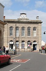
Wellington is a market town in rural Somerset, a county in the west of England, situated 7 miles (11 km) south west of Taunton, near the border with Devon, which runs along the Blackdown Hills to the south of the town. The town has a population of 14,549, which includes the residents of the parish of Wellington Without, and the villages of Tone and Tonedale. Known as Weolingtun in the Anglo-Saxon period, its name had changed to Walintone by the time of the Domesday Book of 1086. Wellington became a town under a royal charter of 1215 and during the Middle Ages it grew as a centre for trade on the road from Bristol to Exeter. Major rebuilding took place following a fire in the town in 1731, after which it became a centre for cloth-making. It is possible that the fire referred to here was actually in Tiverton, Devon which has details of a major fire in the same year. Further information on a major fire in Wellington at this time cannot be found. In 1809, the Crown referenced Wellington when creating a viscountcy for the eventual Duke of Wellington, Arthur Wellesley, after his victory at the Battle of Talavera in the Peninsular War. When the title's name was being considered, Arthur's brother, Richard Wellesley, Earl of Mornington, found an available manor in the parish of Wellington, a name close to the family name. Richard oversaw the manor's purchase while Arthur commanded the army in Spain against the French. The Wellington Monument south of Wellington commemorates Arthur. The Grand Western Canal reached the town in 1835 and then the Bristol and Exeter Railway in 1843. The town's own railway station survived until 1964. Wellington was home of Fox, Fowler and Company, which was the last commercial bank permitted to print their own sterling banknotes in England and Wales. In the 20th century closer links with Taunton meant that many of the residents of Wellington commuted there for work, and the M5 motorway enabled car journeys to be made more easily. Local industries, which now include an aerosol factory and bed manufacturers, are celebrated at the Wellington Museum in Fore street. Wellington is home to the independent Wellington School, and state-funded Court Fields School. It is also home to a range of cultural, sporting and religious sites including the 15th century Church of St John the Baptist. The capital city of New Zealand is named after Arthur Wellesley, 1st Duke of Wellington, being recognised as having some influence in the company that founded the New Zealand town. The New Zealand capital therefore takes its name ultimately from the English town of Wellington in Somerset.

Rockwell Green
Rockwell Green

Rockwell Green is a village near Wellington, in the Somerset West and Taunton district of Somerset, England. It lies just east of the Somerset-Devon border and is overlooked by the Blackdown Hills. The Wellington Monument is visible from almost anywhere in the village. The monument is on the verge of collapsing but is to be substantially rebuilt at the cost of up to £4 million by the National Trust.Rockwell Green has a railway bridge, under which a steam train, the City of Truro, was first recorded travelling at over 100 mph (160 km/h) in 1904. Although this has been the subject of much debate since then, recent research supports the claim. There have been numerous requests for a plaque or monument to be placed at the Beam Bridge hotel or Westford rail bridge: however very little has come of this so far. Two large water towers, both disused, bring a small number of visitors to the village. The older (redbrick) tower was built in the late 19th century and includes a circular steel tank. It has been designated by English Heritage as a Grade II listed building. The more recent concrete tower was built in the 1930s.A number of houses in the original village are council-owned. In 1991 the population was estimated at 1,618. Since then more houses have been built and the population estimate from the 2001 census was 2,246. The population estimate in 2016 was 2,945.The village has a butcher's shop, one pub, a fish and chip shop, a post office, a general store, a church, a beauty salon/hairdressers, a primary school and pre-school, a village hall, and a post office; before moving to Exeter Road the post office was on the east side of Rockwell Green, in a 19th-century building that has been demolished.