place

Bennachie

Archaeological sites in AberdeenshireBronze Age sites in ScotlandHill fortsHill forts in ScotlandIron Age sites in Scotland
Marilyns of ScotlandMountains and hills of AberdeenshireMountains and hills of the Eastern HighlandsMountains and hills of the United Kingdom with toposcopesPictish sites in ScotlandScheduled monuments in Scotland
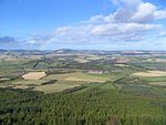
Mither Tap from the South geograph.org.uk 55769

Bennachie ( ben-ə-HEE; Scottish Gaelic: Beinn na Cìche) is a range of hills in Aberdeenshire, Scotland. It has several tops, the highest of which, Oxen Craig, has a height of 528 metres (1,732 ft). Though not particularly high, compared to other peaks within Scotland, the mountain is very prominent, owing to its isolation and the relative flatness of the surrounding terrain, and dominates the skyline from several viewpoints. The peak that stands out the most visually is Mither Tap (518 m, 1699 feet) and from its top there are good views of the county to the north and east. Most of the tops lie along an east / west ridge, with the exception of Millstone Hill (409 m) an outlier or spur which is separated from and to the south of the main ridge. Mither Tap has an Iron Age fort on its summit. Unlike with many other hilltop forts in the area, there are no signs of vitrification in the stone. Bennachie is visible from a number of distant points; to the north it is visible from Longman Hill, a point considerably to the north.

Excerpt from the Wikipedia article Bennachie (License: CC BY-SA 3.0, Authors, Images).

Bennachie
Ruelle du Chanoine Tarde, Sarlat-la-Canéda

Geographical coordinates (GPS) Address Nearby Places
placeShow on map

Wikipedia: BennachieContinue reading on Wikipedia

Geographical coordinates (GPS)

Latitude Longitude
N 57.29275 ° E -2.56244 °
placeShow on map

Address

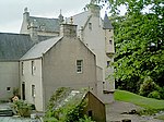
Château de Tarde

Ruelle du Chanoine Tarde
24250 Sarlat-la-Canéda
Nouvelle-Aquitaine, France
mapOpen on Google Maps

Mither Tap from the South geograph.org.uk 55769
Share experience

Nearby Places

The Colony (Bennachie)

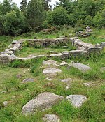
The Colony was a squatters' community on "commonty", or common land, on one side of Bennachie, a range of hills near Aberdeen, in Scotland.From the beginning of the nineteenth century common land in the parishes of Chapel of Garioch and Oyne on the east side of Bennachie became home to a community of squatters. This settlement was known locally as the Colony. Various estimates have been made of when the colony began with some citing 1825 but according to Fagen the first documentary evidence is from 1831. A small number of families led a crofting life supplementing it by doing skilled work, such as dyking, quarrying and knitting.Two stones were landmarks within the colony: the Boddach Stone and the Gouk Stone. Only the latter remains. The size of the colony varied over time. The following table summarises census data extracted from Fagen's text. In 1859, eight neighbouring landlords took possession of sections of Bennachie as part of their estates. This action, recognised in law from 5 March 1859, has become known as the Division of the Commonty. As a result, the population on the side of the hill began to decline. Most of the crofts were built on land claimed by Col. Charles Leslie of Balquhain and Fetternear. His son, Charles Stephen Leslie, was responsible for evicting some of the residents in 1878. The last of the colonists, George Esson, lived on the hill until his death in May 1939. Esson was a drystone dyker. While working on the Dunecht Estate, repairing old dykes and creating new ones, he would lodge with a Mrs Cooper at Dunecht, then walk the twenty miles back to the colony at weekends.Visitors to Bennachie can explore the Colony, including the remains of a croft which was excavated as part of the Fetternear Research Project in 1999.