Laacher See
Calderas of EuropeDormant volcanoesEifelEndorheic lakes of EuropeHotspot volcanoes ... and 6 more
Lakes of Rhineland-PalatinatePages with German IPAPleistocene calderasVEI-6 volcanoesVolcanic crater lakesVolcanoes of Germany

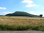
Laacher See (German pronunciation: [ˈlaːxɐ ˈzeː]), also known as Lake Laach or Laach Lake, is a volcanic caldera lake with a diameter of 2 km (1.2 mi) in Rhineland-Palatinate, Germany, about 24 km (15 mi) northwest of Koblenz, 37 km (23 mi) south of Bonn, and 8 km (5.0 mi) west of Andernach. It is in the Eifel mountain range, and is part of the East Eifel volcanic field within the larger Volcanic Eifel. The lake was formed by a Plinian eruption approximately 13,000 years BP with a Volcanic Explosivity Index (VEI) of 6, on the same scale as the Pinatubo eruption of 1991. The volcanic discharge observable as mofettas on the southeastern shore of the lake are signs of dormant volcanism.
Excerpt from the Wikipedia article Laacher See (License: CC BY-SA 3.0, Authors, Images).Laacher See
Geographical coordinates (GPS) Address Nearby Places Show on map
Geographical coordinates (GPS)
| Latitude | Longitude |
|---|---|
| N 50.4125 ° | E 7.27 ° |
Address
56653
Rhineland-Palatinate, Germany
Open on Google Maps


