place

St. Clair River

Border riversCanada–United States borderGreat Lakes WaterwayInternational rivers of North AmericaLake Huron
Lake St. ClairRivers of Chatham-KentRivers of Lambton CountyRivers of Macomb County, MichiganRivers of St. Clair County, MichiganSt. Clair River
Lake St Clair by Sentinel 2

The St. Clair River (French: Rivière Sainte-Claire) is a 40.5-mile-long (65.2 km) river in central North America which flows from Lake Huron into Lake St. Clair, forming part of the international boundary between Canada and the United States and between the Canadian province of Ontario and the U.S. state of Michigan. The river is a significant component in the Great Lakes Waterway, whose shipping channels permit cargo vessels to travel between the upper and lower Great Lakes.

Excerpt from the Wikipedia article St. Clair River (License: CC BY-SA 3.0, Authors, Images).

St. Clair River
Mitterweg,

Geographical coordinates (GPS) Address Nearby Places
placeShow on map

Wikipedia: St. Clair RiverContinue reading on Wikipedia

Geographical coordinates (GPS)

Latitude Longitude
N 42.533055555556 ° E -82.674722222222 °
placeShow on map

Address

Leone Einkaufszentrum

Mitterweg 1
4190 , Burgfried
Oberösterreich, Österreich
mapOpen on Google Maps

Lake St Clair by Sentinel 2
Share experience

Nearby Places

Tashmoo Park

Tashmoo Park was an amusement park in Algonac, Michigan. Opened in 1897, it closed in 1951. Most of it was later demolished, though the dance pavilion remains today, used by a marina to store recreational boats over the winter. The park's name was given to the steamer Tashmoo and probably comes from Lake Tashmoo on Martha's Vineyard. The park was located on Harsens Island in the St. Clair Flats at the northern end of Lake St. Clair. The St Clair Flats is the largest freshwater river delta in the world. Tashmoo Park offered visitors an escape from the oppressive heat and humidity of packed, sweltering Detroit in the summertime. Tashmoo Park had picnic tables, a baseball diamond, swings and rides, as well as a casino and a dancing pavilion. Some visitors swam in the St Clair River. Indians from nearby Walpole Island sold moccasins and beadwork. The park was served by many steamships that travelled several times a day between Detroit and Port Huron, Michigan, delivering passengers and freight. This was during a time when automobiles were rare and roads few. However, the connecting waters of the Great Lakes made steamships travel almost like riding a bus, and up to 250,000 people visited Tashmoo Park in the summers during the 1890s and early 20th century. The most famous steamer was the Tashmoo, which stopped twice daily on trips between Detroit and Port Huron. The park was revived to memory in June 2013 when Dave Leander took a dive in the St. Clair River and found a buried bottle with a message containing a reference to the park. The letter was dated June 30, 1915.

Clinton River (Michigan)

The Clinton River is a river in southeastern Michigan in the United States. It is named in honor of DeWitt Clinton, who was governor of New York from 1817 to 1823. 
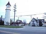
The main branch of the river rises from wetlands and coldwater tributaries from within Independence, Brandon and Springfield townships in Oakland County. A series of dams create a number of small lakes west of Pontiac, the last of which is Crystal Lake. The river is piped under downtown Pontiac, re-emerging to the east of downtown. The north branch and the middle branch rise in northern Macomb County and join the main branch in Clinton Township (which was named after the river in 1824). The main branch flows 83.0 miles (133.6 km) from its headwaters to Lake St. Clair in Harrison Township. 
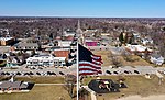
The Clinton River watershed drains 760 square miles (2,000 km2), including most of Macomb County, a large portion of Oakland County, as well as small portions of Lapeer and St. Clair counties. More than 1.4 million people in over 60 municipalities live in the watershed. For the most part, only the waters located downstream of the city of Mount Clemens are navigable by water vessels. Under the Great Lakes Water Quality Agreement in 1972, along with 42 other areas, the lower segment of the river was designated as an Area of Concern, based on the heavy presence of pollutant contamination. In 1995, the designation was expanded to include the entire watershed of the river and the lower nearshore of Lake St. Clair. The Clinton-Kalamazoo Canal was a failed attempt to build a waterway connecting Lake St. Clair with Lake Michigan. It was originally planned to stretch 216 miles, but was abandoned after only 13 miles had been completed. The French explorers of the late 17th century knew the river as the Nottawasippee, an Ojibwe term that means "like rattlesnakes." This was also the name given to the Huron people by the region's Anishinaabe (Ojibwe, Odawa, and Potawatomi) inhabitants.British fur traders referred to it as the Huron River of St. Clair. It was referred to as "the River Huron" in the 1784 home eulogy of the area's first American settler, William Tucker, who built his home along the river about 3 miles (5 km) upstream from its mouth. It received its current name on July 17, 1824. The Michigan Territorial Council made the change in order to end the confusion between this river and the Huron River of Lake Erie, which also rises in Oakland County's Springfield Township.The Huron-Clinton Metroparks system preserves land in the watershed as public parks; Wolcott Mill Metropark is on the north branch of the river.