place

Grange Arch

Arches and vaults in EnglandDorset geography stubsFolly buildings in EnglandGrade II* listed buildings in Dorset
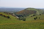
Grange Arch looking NW

Grange Arch, also known as Creech Folly, is an 18th-century folly that is located near the second highest point of the Purbeck Hills, Ridgeway Hill (199 m), in Dorset. It lies within the parish of Steeple. The folly, which was built by a former owner of Creech Grange, Denis Bond, in 1746, is built in the form of a triple arch of ashlar stone. The central archway is surmounted by battlements and flanked by stone walls with smaller doorway arches.Today the arch is owned by the National Trust. English Heritage have designated it a Grade II* listed building.

Excerpt from the Wikipedia article Grange Arch (License: CC BY-SA 3.0, Authors, Images).

Geographical coordinates (GPS)

Latitude Longitude
N 50.6356 ° E -2.1249 °
placeShow on map

Address

Grange Arch

Grange Hill
BH20 5DF , Steeple with Tyneham
England, United Kingdom
mapOpen on Google Maps

linkWikiData (Q15222034)
linkOpenStreetMap (311039083)

Grange Arch looking NW
Share experience

Nearby Places

Steeple, Dorset
Steeple, Dorset

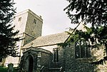
Steeple is a hamlet and former civil parish, now in the civil parish of Steeple with Tyneham, in the Purbeck district of the English county of Dorset. It is situated 8 miles (13 km) west of the coastal resort town of Swanage at the foot of Ridgeway Hill. In 2013 the estimated population of the civil parish was 60. The civil parish was abolished on 1 April 2014 and merged with Tyneham to form Steeple with Tyneham.The Gerrard family of Longhide were the principal landowners here fromb the fourteenth to the sixteenth century; the lands then passed by inheritance to the Napier family. The ancient Norman church of Steeple, dedicated to St Michael and All Angels, lacks a steeple. It has a coat of arms engraved in stone in the porch and another painted in scarlet of the roof interior that is precisely the same as George Washington's coat of arms, showing stars and stripes. The Washington arms is quartered with those of the squires of Steeple village, the Lawrence family, who are allied with the Washingtons by the marriage of one of its sons, Edmund Lawrence, to Agnes de Wessington in 1390. The flag of the US capital hangs inside the church, presented on 25 July 1977 by Walter E Washington, Mayor of Washington DC from 2 January 1975 - 2 January 1979 On the highest local point of the nearby Purbeck Ridge is an 18th-century folly built by the former owner of Creech Grange and known as Grange Arch. Today it is a Grade II listed building owned by the National Trust.

Purbeck Hills
Purbeck Hills

The Purbeck Hills, also called the Purbeck Ridge or simply the Purbecks, are a ridge of chalk downs in Dorset, England. It is formed by the structure known as the Purbeck Monocline. The ridge extends from Lulworth Cove in the west to Old Harry Rocks in the east, where it meets the sea. The hills are part of a system of chalk downlands in southern England formed from the Chalk Group which also includes Salisbury Plain and the South Downs. For most of their length the chalk of the Purbeck Hills is protected from coastal erosion by a band of resistant Portland limestone. Where this band ends, at Durlston Head, the clay and chalk behind has been eroded, creating Poole Bay and the Solent. The ridge of steeply dipping chalk that forms the Purbeck Hills continues further east on the Isle of Wight. The height of the chalk ridge and proximity to Poole Harbour and the south coast have made the hills of strategic importance. There are a number of Iron Age, Roman and Saxon archaeological sites, such as Nine Barrow Down. At Corfe Castle the hills are broken twice leaving a steep round hill between the ridges on which stood a medieval castle, guarding the only easy route through the hills, until the English Civil War of the 17th century, when it was slighted. Some of the ridge, around the village of Tyneham, near Lulworth, has been closed to the public for use by the army as a firing range. This has protected them from damage from farming and development, and these areas are now nature reserves. At the eastern end Ballard Down is a National Trust nature reserve which is managed for its calcareous grassland habitat.