place

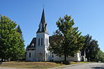
Lovell General Hospital North

Closed medical facilities of the United States ArmyDefunct hospitals in MassachusettsFort DevensHospitals in Middlesex County, MassachusettsMassachusetts building and structure stubs
Military facilities in MassachusettsMilitary hospitals in the United StatesNortheastern United States hospital stubs

The Lovell General Hospital North is a former hospital at Fort Devens. It was named after the first Surgeon General of the United States Army, Joseph Lovell.

Excerpt from the Wikipedia article Lovell General Hospital North (License: CC BY-SA 3.0, Authors).

Lovell General Hospital North
Frost Street,

Geographical coordinates (GPS) Address Nearby Places
placeShow on map

Wikipedia: Lovell General Hospital NorthContinue reading on Wikipedia

Geographical coordinates (GPS)

Latitude Longitude
N 42.545358333333 ° E -71.636833333333 °
placeShow on map

Address

Ayer Shirley Regional Middle School

Frost Street
01464
Massachusetts, United States
mapOpen on Google Maps

Share experience

Nearby Places

Fort Devens Historic District

The Fort Devens Historic District is a historic district roughly bounded by El Caney St., Antietam St., Sherman Ave., MacArthur Ave. and Buena Vista Street in Devens, Massachusetts, encompassing territory in both Ayer and Harvard. The district is in a portion of the former Fort Devens and includes a large number of historically and architecturally significant buildings. The buildings that are deemed of most significant historic importance are those that were built in the period 1929-39. This building phase was begun after the United States Army decided to upgrade temporary facilities dating from World War I, to provide more permanent facilities at the base. This resulted in the construction of a significant number of Georgian Revival buildings in a rough U shape around a central parade ground. These buildings included dormitory facilities for soldiers, administrative office space, and warehouse facilities. This area is also significant as the site from 1933 to 1937 of an encampment of the Civilian Conservation Corps, and for its association with Congresswoman Edith Nourse Rogers, without whose efforts the base might have been closed instead of being upgraded.The district was added to the National Register of Historic Places in 1993. Its main boundaries on the north, west, and south, are Antietam and El Caney Streets. The eastern boundary is mainly Jackson Street, although there is an extension further eastward to Auman Avenue, where there are rows of single-family housing. One of the most visually dominant elements of the district are Rogers Field, the former parade ground, and the grouping of former barracks buildings on its north side.

Shirley Shaker Village

Shirley Shaker Village is a historic former Shaker community in Lancaster and Shirley, Massachusetts. Defined as an historic district, it includes about half of the original buildings and is listed on the National Register of Historic Places. The Shirley Shaker Village began in 1793. Hundreds of acres of land was donated by John Warren, Elijah and Ivory Wildes, and Nathan Willard near their properties. At its peak there were 26 buildings; Now there are 13. Within the community there were the North, South and Church families. By 1853 there were 150 believers, or members, and the community continued into the 20th century. The buildings were first made of clapboard and painted yellow and white. After the 1840s and the founding of a brick factory nearby, new buildings were constructed of brick. The brick administration building was styled similarly to one at the Canterbury Shaker Village in New Hampshire. The interiors of the buildings were described by William Dean Howells in 1875 as "the unpapered walls, the scrubbed floors hidden only by rugs and strips of carpeting, and the plain flat finish of the wood-work. Each chamber accommodates two brothers or sisters, and is appointed with two beds, two rocking chairs, two wash stands, and a wood stove with abundance of rugs. There were few tokens of personal taste in the arrangements of the rooms." The Shakers earned income by producing and selling jellies, applesauce, herbs, mops and brooms. When the community dwindled and they were no longer able to be self-supporting, in 1908 "believers" moved to the Hancock Shaker Village.The state purchased the property in 1909 and adapted it for use as an "industrial school" for troubled and delinquent boys. Extensive changes were made to the property, resulting in the movement, alteration, and demolition of buildings. In 1971 the school was closed. New construction was done on site and the total facility was converted into the Massachusetts Correctional Institution complex. A historic district, encompassing the Shaker-related resources on more than 700 acres (280 ha) of land in Shirley and Lancaster, was defined and listed on the National Register of Historic Places in 1976. The Shirley Historical Society arranges periodic tours of the former Shirley Shaker Village.Several other Shaker village sites operate today as museums. A similar community was founded in nearby Harvard. The meetinghouse of Shirley Shaker Village was moved in 1962 to Hancock Shaker Village in Pittsfield to replace an identical one which burned and then was razed in 1938.Today, only one "society" remains in the control of the last Shakers, located at Sabbathday Lake Shaker Village in New Gloucester, Maine.