Fern Ridge, Langley
Mennonitism in British ColumbiaMetro Vancouver geography stubsNeighbourhoods in Langley, British Columbia

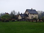
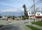
Fern Ridge is a neighbourhood of Langley, British Columbia. It is located in the southwestern area of Langley Township, near Campbell Valley Regional Park. 200th Street, or Carvolth Road, runs south through Fern Ridge, and TransLink provides hourly bus service during daylight hours to Langley City. There is one church in the community, a Mennonite church.
Excerpt from the Wikipedia article Fern Ridge, Langley (License: CC BY-SA 3.0, Authors, Images).Fern Ridge, Langley
207 Street,
Geographical coordinates (GPS) Address Nearby Places Show on map
Geographical coordinates (GPS)
| Latitude | Longitude |
|---|---|
| N 49.05 ° | E -122.65 ° |
Address
207 Street
207 Street
V2Z 1X1 , Fern Ridge (Brookswood-Fernridge)
British Columbia, Canada
Open on Google Maps


