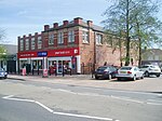
Gateford is a village in Nottinghamshire, England. It is located 1 mile north-west of Worksop and was first recorded by name as Gattef (meaning goats’ ford), circa 1130. Archaeological information however reveals a longstanding human settlement in the Gateford landscape, and to the north of the village there are three circular cropmarks thought to be Bronze Age barrows. A bronze flanged axe was discovered at Gateford Farm in 1962. Irregular fields, lanes and settlement enclosures in the same area are thought to reflect a Romano-British rural landscape (A.D. 43-410), with various Roman period artefacts having been unearthed, including coins from the reign of Nero and Domitian, which were uncovered at Gateford Hall in the early 19th century. These conclusions were backed up in 2013 by the University of Leicester Archaeological Services (ULAS), who conducted a geophysical survey of the site in thirteen trenches, many of which contained Romano-British pottery dating from the 2nd century AD. They also discovered linear features representing enclosure ditches and gullies, most likely associated with the outlying enclosures of an Iron Age or Romano-British farm. The later village grew from lands on the estate of Gateford Hall, the medieval moated manor house which was largely rebuilt in the 17th century, and is now a Grade 2 listed building. Gateford's present day boundaries are Gateford Road (A57), Owday Lane, Carlton Road (A60) and Raymoth Lane.
Gateford is steeped in an almost hidden away history that at times seems hard to find, and since 1995 has been largely redeveloped to become a very modern looking community, specifically relating to the building of thousands of new homes and that of the Celtic Point shopping area. This said, its charm and character remains, with acres of woodland, ponds and streams, together with an abundance of wildlife, and agricultural farm land, beset to the backdrop of Gateford Hill, which in turn covers a large swathe of the landscape. A separate Gateford Hill (the manor house that was Gateford Hall), boasts an attractive private, unregistered historic park and garden, with a wide range of large mature trees. Gateford's green areas include Eddison Plantation, Sand Hill Plantation, Keeper's Ashes, Hardwick Ashes, Little Broom Wood, Nab's Ashes Woods, Whipman Wood, Owday Plantation and Owday Woods.
A number of historical and architecturally important buildings were designated as the Old Gateford Conservation Area on 4th February 2009, that includes the aforementioned Gateford Hall, Gateford Hill House, California Farm, the 18th and 19th century cottages on Old Gateford Road, a number of outbuildings, Ivy Cottage, Otley Cottage, Forge House, a small industrial area known as ‘the Smithy’ and a listed icehouse associated with Gateford House.
Numerous public footpaths link Gateford to its neighbouring villages and to the town of Worksop.
The community is served by Gateford Park Primary School with a second school due to open on Gatekeeper Way in September 2024. Gateford Park Primary School's Key Stage 2 indoor athletics team became the district champions in 2012. Gateford's village sign was created by schoolchildren based on local Roman finds.
The Roman's Rest public house provides regular live entertainment and a good food selection.


