place

Ethelton, South Australia

Lefevre PeninsulaSuburbs of AdelaideUse Australian English from August 2019

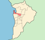
Ethelton is a north-western suburb of Adelaide 13 km (8.1 mi) from the CBD, on the Lefevre Peninsula, in the state of South Australia, Australia. It is a residential suburb within the local government area of City of Port Adelaide Enfield, adjacent to the suburbs of Semaphore, Semaphore South, Glanville and New Port. It is bounded to the north by Hart Street, to the south by Bower Road and in the west by Swan Terrace and in the east by Causeway Road.

Excerpt from the Wikipedia article Ethelton, South Australia (License: CC BY-SA 3.0, Authors).

Ethelton, South Australia
Pelham Street, Adelaide Ethelton

Geographical coordinates (GPS) Address Nearby Places
placeShow on map

Wikipedia: Ethelton, South AustraliaContinue reading on Wikipedia

Geographical coordinates (GPS)

Latitude Longitude
N -34.850335 ° E 138.489005 °
placeShow on map

Address

Pelham Street

Pelham Street
5015 Adelaide, Ethelton
South Australia, Australia
mapOpen on Google Maps

Share experience

Nearby Places

St Francis House

St Francis House was a home for inland Aboriginal Australian boys from 1946 to 1959 at Glanville Hall in Semaphore South, Adelaide, South Australia. Father Percy Smith purchased Glanville Hall on behalf of the Anglican Church to provide accommodation for young Aboriginal boys from remote areas who were attending school in the local area. He founded the St Francis Boys' Home in order to bring boys down (including several from Alice Springs in the Northern Territory) for education and employment.In a time when it was commonly believed that Aboriginal children were unable to be educated beyond Grade 3, Smith saw the home as a way of providing a family environment for the children to pursue a higher level of education without losing their Aboriginal identity. He described the hostel as “not one of fostering, but rather a boarding establishment to which boys came with their mothers' consent for the school year, and in that respect it was no different from children being sent by their parents to a boarding school".The manor became known as "St Francis House: A Home for Inland Children" and over the next 14 years, more than 50 children found at home at St Francis on their way to greatness. Former residents include Charles Perkins , Gordon Briscoe , John Moriarty , Les Nayda , and Bill Espie (Queen's Medal for Bravery) and the artist Harold Thomas (activist) (Bundoo) who signed a $20m agreement with the Australian Government to secure the rights to the Aboriginal flag, meaning it can now be reproduced without a fee. Some notable sporting identities included Vincent Copley, Richie Bray and Ken Hampton went on to play football for Port Adelaide, while Wally McArthur became an accomplished track and field athlete as well as rugby player. Many other residents went on to lead successful and fulfilled lives.Moriarty has said that St Francis House was an exceptional home. At St Francis House, the boys formed a strong, life-long bond with Smith and his wife, and with each other.A history of St Francis House is being written by former Australian test cricketer Ashley Mallett.The St Francis House Project was established in 2018 to document the history of the home.

Jervois Bridge

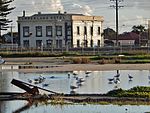
The Jervois Bridge is a bridge in Greater Adelaide, Australia that crosses the Port River. Construction of the original 98 m (322 ft) Jervois Bridge from Port Adelaide to Ethelton commenced in July 1875, using components manufactured in England by Westwood, Baillie. It was the first swing bridge in Australia, with mechanical equipment provided by William Armstrong & Co of Newcastle upon Tyne.Built to carry pedestrian, rail and road traffic, it was officially opened on 7 February 1878 by the Governor of South Australia, William Jervois, after whom it was named.By 1924, it had ceased to be used by rail traffic, after the line had been diverted. Operation of the swing bridge passed from the South Australian Railways to the Harbours Board in December 1924. In 1937, the control tower and its support gantry were elevated to allow use by double-decker AEC 661T trolleybuses.The original bridge closed in August 1966 to make way for a new bridge. It was later demolished with the control tower and supporting gantry moved to Nile Street, where it remained as an entrance to the Fishermen's Wharf Market car park until 2016, when the carpark was partially redeveloped for a new office building. The control tower and supporting gantry were removed to the Council depot for restoration, with the intention of finally moving it to the Hart's Mill site, close to its original location. The remnants of the original bridge received a Historic Engineering Marker from Engineers Australia as part of its Engineering Heritage Recognition Program.The new four-lane bridge was constructed on an alignment a short distance upstream, opening on 28 July 1969.Upstream (south) of the Jervois Bridge lies the Jervois Basin Ships' Graveyard, and beyond that the railway bridge carrying the Outer Harbor railway line.