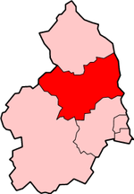
Bilton Banks, Northumberland
Use British English from August 2019Villages in Northumberland
Bilton Banks was a village in Northumberland adjacent to the coal mines of Shilbottle and Longdyke. It was home to many miners’ families from the late 19th century through the mid 20th century when the mines were finally closed and the houses condemned and demolished. Today there is nothing to show that, for almost three quarters of a century, a close-knit community of dozens of working families lived and worked there but still, hidden beneath a peaceful agricultural scene, lie the tunnels and workings in which they laboured to bring up the coal to feed British industry.
Excerpt from the Wikipedia article Bilton Banks, Northumberland (License: CC BY-SA 3.0, Authors).Bilton Banks, Northumberland
Geographical coordinates (GPS) Address Nearby Places Show on map
Geographical coordinates (GPS)
| Latitude | Longitude |
|---|---|
| N 55.3847 ° | E -1.6708 ° |
Address
NE66 2HQ
England, United Kingdom
Open on Google Maps


