place

St. Patrick's Roman Catholic Church (Bisbee, Arizona)

1915 establishments in Arizona20th-century Roman Catholic church buildings in the United StatesBisbee, ArizonaBuildings and structures in Cochise County, ArizonaCatholic Church in Arizona
Churches on the National Register of Historic Places in ArizonaGothic Revival church buildings in ArizonaHistoric district contributing properties in ArizonaNational Register of Historic Places in Cochise County, ArizonaRoman Catholic churches completed in 1915Roman Catholic churches in ArizonaUse mdy dates from August 2023
St. Patrick's, Bisbee, AZ

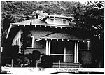
St. Patrick's Roman Catholic Church is a historic church on Oak Avenue, on Higgins Hill in Bisbee, Arizona, United States. It was built in 1915 and added to the National Register of Historic Places in 1995. It was designed by architect Albert C. Martin of Los Angeles.It was deemed significant "because it embodies distinct characteristics of the Late Gothic Revival period of architecture and high artistic value in its decorative fittings, most specifically the stained glass windows and alters."It is a contributing building in the Bisbee Historic District. It is located about 200 feet up Higgins Hill, on the southerly side of Tombstone Canyon.

Excerpt from the Wikipedia article St. Patrick's Roman Catholic Church (Bisbee, Arizona) (License: CC BY-SA 3.0, Authors, Images).

St. Patrick's Roman Catholic Church (Bisbee, Arizona)
Tombstone Canyon Road,

Geographical coordinates (GPS) Address Nearby Places
placeShow on map

Wikipedia: St. Patrick's Roman Catholic Church (Bisbee, Arizona)Continue reading on Wikipedia

Geographical coordinates (GPS)

Latitude Longitude
N 31.444444444444 ° E -109.92194444444 °
placeShow on map

Address

Tombstone Canyon Road 305
85603
Arizona, United States
mapOpen on Google Maps

St. Patrick's, Bisbee, AZ
Share experience

Nearby Places

Lavender Pit
Lavender Pit

The Lavender Pit is a former open pit copper mine near Bisbee in Cochise County, Arizona, United States. It is located near the famous Copper Queen Mine. The Lavender Pit was named in honor of Harrison M. Lavender (1890–1952), who as Vice-President and General Manager of Phelps Dodge Corporation, conceived and carried out this plan for making the previously unprofitable low-grade copper bearing rock of the area into commercial copper ore. Phelps Dodge Corporation opened the Lavender Pit in 1950, at the site of the earlier, higher-grade Sacramento Hill mine. Production through 1974 totaled 86 million tons of ore averaging about 0.7% copper, or about 600,000 tons of copper produced, with gold and silver as byproducts. About 256 million tons of waste were stripped, but a portion of this was acid-leached for additional copper. Turquoise was also a by-product of this mining activity. Bisbee turquoise, also known as Bisbee Blue, is amongst the finest turquoise found anywhere in the world. Mining operations in the pit ended in 1974. The undeveloped Cochise deposit, located immediately north of the Lavender pit, contains an estimated 190 million tons of rock containing 0.4% acid-soluble copper, which may be mined in the future. Because of the competent host rock, this pit has much steeper sides than other open pit copper mines in the southwest area. The pit covers an area of 300 acres (1.2 km²), and is 900 feet (274 m) deep. Large tonnages of dump rock are placed around Bisbee, notably north of the residential district of Warren and other parts of the southeastern Mule Mountains area.