place

Saint Patrick's Roman Catholic Church (Independence, Oregon)

1874 establishments in Oregon19th-century Roman Catholic church buildings in the United StatesBuildings and structures in Polk County, OregonChurches on the National Register of Historic Places in OregonFormer Roman Catholic church buildings in Oregon
Independence, OregonIndividually listed contributing properties to historic districts on the National Register in OregonNRHP infobox with nocatNational Register of Historic Places in Polk County, OregonOregon Registered Historic Place stubsOregon building and structure stubsRoman Catholic Archdiocese of Portland in OregonRoman Catholic churches completed in 1874Use mdy dates from August 2023Western United States church stubs
Saint Patrick's Roman Catholic Church Independence

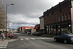
Saint Patrick's Roman Catholic Church (also known as Methodist Episcopal Church, South) is a historic church building at 330 Monmouth Street in Independence, Oregon. It was built in 1874 and added to the National Register in 1987.

Excerpt from the Wikipedia article Saint Patrick's Roman Catholic Church (Independence, Oregon) (License: CC BY-SA 3.0, Authors, Images).

Saint Patrick's Roman Catholic Church (Independence, Oregon)
River Road,

Geographical coordinates (GPS) Address Nearby Places
placeShow on map

Wikipedia: Saint Patrick's Roman Catholic Church (Independence, Oregon)Continue reading on Wikipedia

Geographical coordinates (GPS)

Latitude Longitude
N 44.851345 ° E -123.187841 °
placeShow on map

Address

Independence Historic District

River Road
97351
Oregon, United States
mapOpen on Google Maps

Saint Patrick's Roman Catholic Church Independence
Share experience

Nearby Places

Ash Creek (Polk County, Oregon)

Ash Creek is a short stream in Polk County, in the U.S. state of Oregon. Formed by the merger of its north and middle forks near Monmouth, it flows generally east to meet the Willamette River at Independence. The creek passes under Oregon Route 51 just before entering the river. The creek's mouth is about 95 miles (153 km) upstream of the Willamette's confluence with the Columbia River.North Fork Ash Creek begins at the eastern edge of the Central Oregon Coast Range near Dallas at 44°54′35″N 123°21′44″W and flows generally southeast to meet the Middle Fork. Middle Fork Ash Creek begins at 44°53′26″N 123°17′37″W near Mount Pisgah and flows generally east. Both forks pass under Oregon Route 99W shortly before they merge to form the main stem.Ash Creek is joined by a third fork, South Fork Ash Creek, in Independence. The South Fork begins at 44°52′36″N 123°18′28″W slightly south of the Middle Fork and flows generally east to meet the main stem at 44°51′13″N 123°11′36″W The South Fork passes under Route 99W south of Monmouth and under Route 51 in Independence.None of the three forks has a named tributary. Before alterations by settlers in the 19th century, the basin was a "boggy, 'braided' marsh with many small creeks spilling into Ash Creek" and the river. European-Americans drained and leveled wetlands and riparian zones for farming, logging, housing, and urban development.