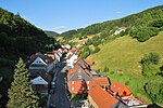
Schindelkopf
Göttingen (district)Mountains of Lower SaxonyMountains of the HarzMountains under 1000 metres
The Schindelkopf (629 m above sea level (NN)) in the Harz Mountains of central Germany is a southwestern outlier of the mountain ridge known as Auf dem Acker (865.1 m). It is located near the town of Osterode am Harz within the unincorporated area of Harz which is in the district of Göttingen in the state of Lower Saxony.
Excerpt from the Wikipedia article Schindelkopf (License: CC BY-SA 3.0, Authors).Schindelkopf
Nasser Weg, Harz (Landkreis Göttingen)
Geographical coordinates (GPS) Address Nearby Places Show on map
Geographical coordinates (GPS)
| Latitude | Longitude |
|---|---|
| N 51.721139 ° | E 10.339583 ° |
Address
Nasser Weg
Nasser Weg
37520 Harz (Landkreis Göttingen)
Lower Saxony, Germany
Open on Google Maps


