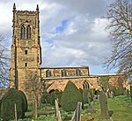
South East Derbyshire Rural District
South East Derbyshire was a rural district in Derbyshire, England from 1894 to 1974. It covered an area to the south-east of Derby. It was formed as Shardlow rural district under the Local Government Act 1894, mainly from the Derbyshire part of the Shardlow rural sanitary district (the Leicestershire part becoming Castle Donington Rural District, and most of the Nottinghamshire part becoming Stapleford Rural District). It also administered the parishes of Ratcliffe on Soar and Kingston on Soar in Nottinghamshire – these became part of Leake Rural District in 1927. The district was renamed South East Derbyshire in 1959. It was abolished under the Local Government Act 1972, with the parishes of Breadsall, Breaston, Dale Abbey, Draycott and Church Wilne, Hopwell, Little Eaton, Morley, Ockbrook, Risley, Sandiacre, Stanley, Stanton by Dale and West Hallam going on to form part of the new Erewash district, with the rest becoming part of a new South Derbyshire district.
Excerpt from the Wikipedia article South East Derbyshire Rural District (License: CC BY-SA 3.0, Authors).South East Derbyshire Rural District
Main Road, Derby Boulton Moor
Geographical coordinates (GPS) Address Phone number Website Nearby Places Show on map
Geographical coordinates (GPS)
| Latitude | Longitude |
|---|---|
| N 52.89 ° | E -1.38 ° |
Address
Beechwood Park
Main Road
DE72 3EQ Derby, Boulton Moor
England, United Kingdom
Open on Google Maps


