Tirley
Gloucestershire geography stubsUse British English from March 2015Villages in Gloucestershire

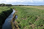
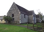
Tirley is a village and civil parish in Gloucestershire, England. It is located in the Borough of Tewkesbury district, 4 mi (6 km) south-west of Tewkesbury town and 6 mi (10 km) north of Gloucester. The village is situated on a low limestone ridge just above the flood plain of the River Severn. It is on the B4213 road, half a mile west of Haw Bridge, a crossing point on the Severn since the 13th century.The parish population at the 2011 census was 428.It has a parish church dedicated to St Michael and All Angels.
Excerpt from the Wikipedia article Tirley (License: CC BY-SA 3.0, Authors, Images).Tirley
Geographical coordinates (GPS) Address Nearby Places Show on map
Geographical coordinates (GPS)
| Latitude | Longitude |
|---|---|
| N 51.95 ° | E -2.24 ° |
Address
GL19 4EZ , Tirley
England, United Kingdom
Open on Google Maps


