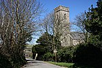
Creegbrawse
Carrick geography stubsHamlets in Cornwall
Creegbrawse is a hamlet in west Cornwall, England, United Kingdom. It is situated between the villages of Chacewater (where the 2011 census population was included ) and Todpool approximately three miles (5 km) east of Redruth.Creegbrawse was a busy mining area in the 19th century. Remains of the mining activity are still present including numerous mineshafts. Since the decline of the industry, the village has become a rural community centred on a crossroads; the roads lead to Chacewater, Twelveheads, Todpool and St Day via Little Beside.
Excerpt from the Wikipedia article Creegbrawse (License: CC BY-SA 3.0, Authors).Creegbrawse
Geographical coordinates (GPS) Address Nearby Places Show on map
Geographical coordinates (GPS)
| Latitude | Longitude |
|---|---|
| N 50.248 ° | E -5.164 ° |
Address
TR4 8SH , Chacewater
England, United Kingdom
Open on Google Maps


