Clevedon
Beaches of SomersetCivil parishes in SomersetClevedonPopulated coastal places in SomersetPorts and harbours of Somerset ... and 3 more
Seaside resorts in EnglandTowns in North SomersetUse British English from August 2012

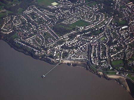
Clevedon (, KLEEV-dən) is a seaside town and civil parish in the unitary authority of North Somerset, England. It recorded a parish population of 21,281 in the United Kingdom Census 2011, estimated at 21,442 in 2019. It lies along the Severn Estuary, among small hills that include Church Hill, Wain's Hill (topped by the remains of an Iron Age hill fort), Dial Hill, Strawberry Hill, Castle Hill, Hangstone Hill and Court Hill, a Site of Special Scientific Interest with overlaid Pleistocene deposits. It features in the Domesday Book of 1086. Clevedon grew in the Victorian period as a seaside resort.
Excerpt from the Wikipedia article Clevedon (License: CC BY-SA 3.0, Authors, Images).Clevedon
Madeira Road,
Geographical coordinates (GPS) Address Nearby Places Show on map
Geographical coordinates (GPS)
| Latitude | Longitude |
|---|---|
| N 51.438 ° | E -2.854 ° |
Address
Madeira Road 18
BS21 7TJ , Walton Park
England, United Kingdom
Open on Google Maps


